
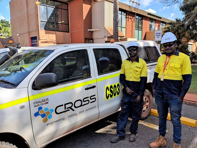
Cross Solutions Cements Relationship with Key Mining Operators in the Northern Territory & FNQ
Cross Solutions have been providing mine survey services for more than 30 years.
You have successfully submitted your enquiry. Someone from our company will respond ASAP

Cross Solutions offers high-quality surveying and mapping solutions for the mining industry.
We have gained industry-leading experience and knowledge across the surveying and spatial science sector, for which we offer as a complete range of services.
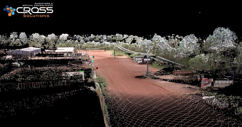
These include mine surveys, geographic information system (GIS) support, unmanned aerial vehicle (UAV) surveys, laser scanning, drafting and visualisation.
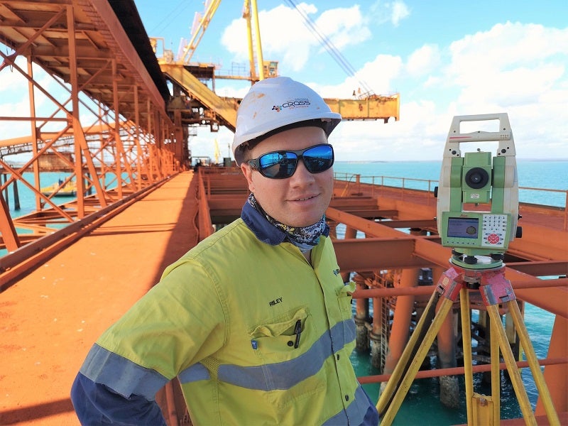
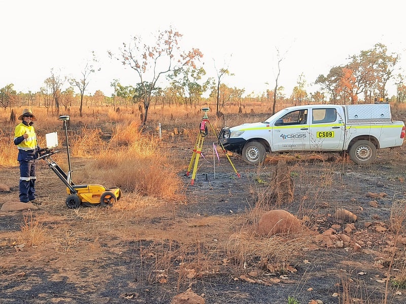

Cross Solutions offers mine-ready and fully trained personnel, as well as the latest equipment and vehicles, to assist companies in the exploration, development and operation of their mining interests.
Our comprehensive service ranges from the initial lease surveys to operational mine support in order to ensure we deliver streamlined and cost-efficient solutions.
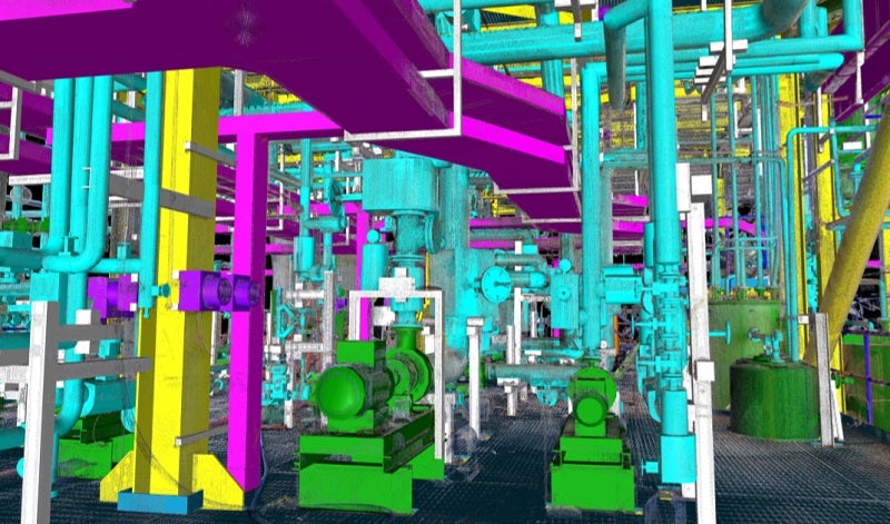
Our surveying portfolio includes 3D terrestrial or mobile laser scanning, exploration gridding, ore body reconciliation, extraction control, surface modelling, and mining leases. We also perform rehabilitation, auditing, mine planning and drilling programmes.
A GIS is designed to capture, store, manipulate, analyse, manage and display all types of geographical data.
Our GIS services include software training and support, web mapping website development and hosting, field capture and management systems, and spatial data management, conversions and integration into existing systems.
We also provide location feasibility studies, hydrological modelling, line-of-sight (LOS) and shadow modelling, land information system (LIS) development, and mapping and cartography.
Cross Solutions has extensive experience with mapping and calculating water volumes particularly with mine tailings dams. We have also completed many previous surveys of flooded mine pits for dewatering calculations and rehabilitation projects
We perform hydrographic surveys for applications such as underwater 3D modelling, sedimentation monitoring and quantity calculations for dredging works.
We also have specifically developed unmanned remote-control solutions so we can undertake hydrographic surveys for hazardous caustic ponds.
Using high-quality equipment and training capabilities, Cross Solutions supplies a comprehensive range of surveying and mapping services that enable our clients to deliver projects and make more informed decisions.
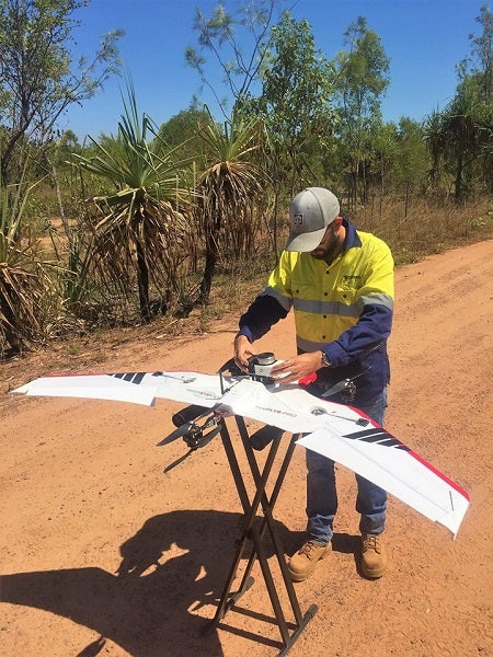
We offer multiple drone configurations, depending on the application requirements. With current senor technology and the right conditions, we can provide you with aerial red, green and blue (RGB) imagery up to 10mm in resolution.
Combined with accurate surveys to geo-reference and locate the image to real-world coordinates, this is suitable for planning monitoring and mapping applications.
Cross Solutions offers inspection and mapping services using drones and remotely piloted aircraft systems (RPAS) operated by personnel approved by the Australian civil aviation authority (CASA).
We also have certified pilots and operate with a ReOC certification for commercial applications.
Cross Solutions’ experienced team of licensed surveyors work closely with clients to understand your requirements and can streamline every stage of a property development.
Surveys lodged with the Surveyor General for approval require a process of examination of the survey plan, reports and digital data to verify compliance with the relevant legislation and standards.
We are certified to ISO 9001 (Quality), AS/NZS 4801 (OHS) and ISO 14001-(environmental).
Cross Solutions have suitably qualified and experienced licensed surveyors with extensive experience in a cadastral survey for mineral leases, licences, retentions and permits. The relevant fieldwork plans and documentation can be undertaken by us to meet the requirements of the legislation. We can also provide surveying services to re-establish and mark existing parcel boundaries or easements.
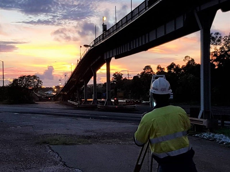
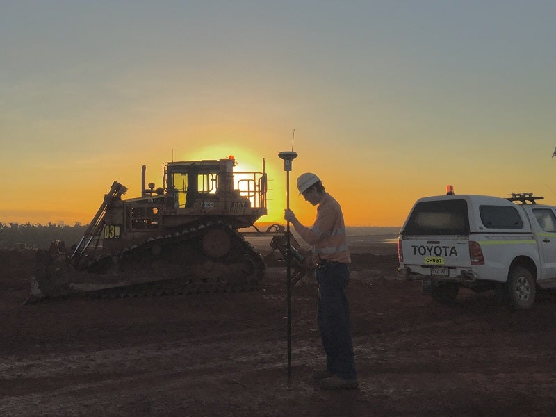
Over our 30 years of operation, Cross Solutions has been involved in many of the largest construction projects in the Northern Territory.
Projects for the construction of material processing plant, materials handling plant, roads, bridges, major civil, tailings ponds, high-density residential/commercial buildings, renewable energy projects, and oil & gas processing facilities, providing services such as:
For more than 30 years, Cross Solutions has provided surveying solutions on projects across the Northern Territory (NT).
We have supported projects such as the Alcan G3 Expansion in Gove, Lendlease Delamere Defence Upgrades and Ichyth’s INPEX Gas Processing Plant Construction. In addition, our client base includes Alcan Gove, Rio Tinto, MMC, Thales, Aurecon and the NT Department of Infrastructure, Planning and Logistics (DIPL).
Cross Solutions have been providing mine survey services for more than 30 years.
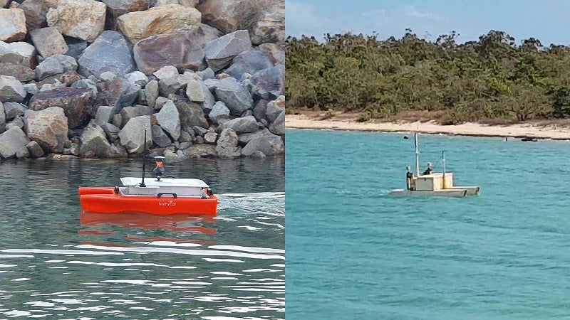
The Bathycat is a new Autonomous RC Hydrographic survey vessel to its fleet.