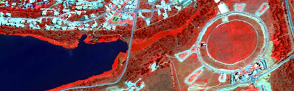
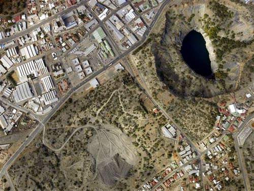
Southern Mapping is a world leader in providing topographic surveying and mapping for the mining sector. Its team of highly skilled surveying and geographical information system (GIS) staff offer services to support mineral exploration, mine management, planning and rehabilitation.
The company combines aerial LiDAR and hyperspectral technologies to produce highly accurate surveys and maps. It is a priority for the company to extend its knowledge and technical expertise into Africa and support the growth of infrastructure development throughout the continent. A sample of our clients includes BHP Billiton, Vale, Angelo America, De Beers and Exxaro.
Lidar mapping for the mining industry
The Southern Mapping team has surveyed mines and exploration areas in many countries across the globe. Our professional survey results are used for a number of applications throughout the lifecycle of a mine. Our key mining sector services include aerial surveys for:
SMC uses aerial lidar and hyperspectral technologies to provide topographic surveying and mapping for the mining sector.
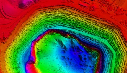
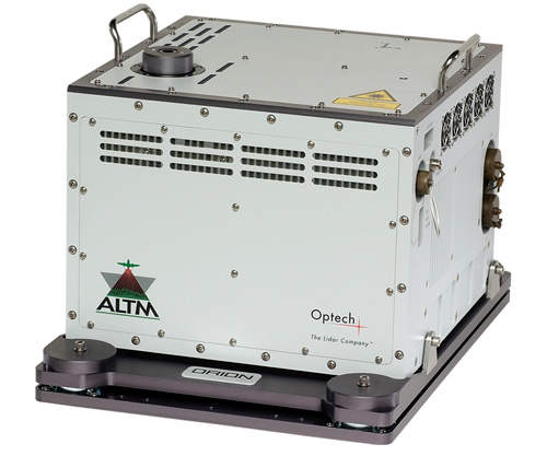
The Orion airborne laser terrain mapper (ALTM) provides highly accurate and dense topographic mapping through the use of laser distance-measuring technology.
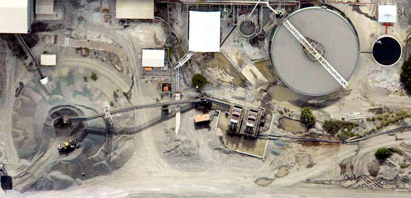
SMC can provide aerial mapping for stockpile and pit volumes.
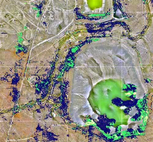
Hyperspectral surveys from SMC offer detailed spectral data for many diverse mining applications.
SMC provides highly detailed, accurate and customised lidar and hyperspectral surveys.
Mineral exploration
Environmental rehabilitation
Stockpile & pit volumes
Acid mine drainage monitoring
Disaster planning
GIS data capturing
Calculation of pit and stockpile volumes
Audit surveys
As-build surveys
Infrastructure design
Mine expansion planning
Surveys in dangerous or inaccessible places
Slimes dams design, survey and monitoring
High-accuracy DTM for enhanced geophysical analysis
Mine design and planning
Risk measurement
Tailings dam monitoring
Pollution apping
Leak detection
Hyperspectral remote sensing technology
Hyperspectral remote sensing, a result of the integration of optical remote sensing and traditional spectroscopic technologies, allows for the differentiation of unique spectral signatures of targets on the surface of the earth.
Hyperspectral systems now make it possible to collect and analyse hundreds of spectral bands across the electromagnetic spectrum, providing detailed spectral data previously not possible through multi-spectral systems.
Hyperspectral mining applications
The huge volumes of multi-dimensional data collected by hyperspectral systems make a wide diversity of mining applications possible. Southern Mapping can assist mine management in detecting mineral deposits, indentifying and monitoring mining operations, as well as providing an accurate assessment of the extent of how tailings (dumps) have changed over time, which is necessary in calculating the lifecycle of a mine. Mine pollution supervision is a primary objective at mines. Hyperspectral imagery allows the mining industry and environmental managers to obtain spatially comprehensive and accurate data for mapping and monitoring effects that the mine has on the environment, which assists in ensuring that rehabilitation measures are adhered to.
Southern Mapping Company Pty Ltd, or SMC, was formed on 1 December 2006 with the aim of providing aerial LiDAR surveys to clients worldwide. SMC formed a watershed in the history of survey in Africa as it became the first independtly owned LiDAR company based on the continent.
Mining Indaba 2013 has come and gone - and what an Indaba it turned out to be! This year's Mining Indaba was the largest ever, with over 7,700 participants from all over the world. The continued growth of the event is testament to the unrivalled opportunities in African Mining.
Early in 2012, Southern Mappings' Operations Division moved out to Grand Central Airport - how time flies! It has now been a full year since the relocation and for the past 12 months we have been operating on our own Air Service Licence issued by the South African Civil Aviation Authority.
The positive, changing face of the African continent is continuing to attract the lion's share of global exploration dollars as prospectors zoom in on its untold mineral riches.
Southern Mapping Company (SMC) and Opten Solutions of Russia have signed a memorandum of understanding to further advance cross-border know-how and scope of work to expand on the offering to clients on all continents. Opten supplies tailored integrated engineering solutions using st
Sishen Mine, owned by Kumba Iron Ore, is one of the world’s seven largest open-pit mines, and is still expanding. To assist the company in planning for increased production, Southern Mapping Company (SMC) was contracted to perform an aerial Lidar survey. Hein Pienaar, chief mine su
With concerns about global warming and the damage of carbon emissions on the rise, companies across the globe are starting to be more proactive in finding ways to become 'greener' enterprises. Southern Mapping Company (SMC) has partnered with Peace Parks to help contribute towards this global gre
Africa produces more than 60 metal and mineral products and is a major producer of several of the world’s most important minerals and metals including gold, diamonds, uranium, manganese, chromium, nickel, bauxite and cobalt. Although underexplored, Africa hosts about 30% of the planet's mineral r