
Improving Convergence Monitoring Using Lidar Data At Rio Tinto’s Argyle Diamond Mine
Rio Tinto engaged LiDAR specialist MINELiDAR to demonstrate an improved method for convergence monitoring.

Emesent is a world-leader in drone autonomy, LiDAR mapping, and data analytics. Our vision is to be the leading explorers of autonomous digitalization in the most challenging and seemingly unreachable places on Earth and beyond.
You have successfully submitted your enquiry. Someone from our company will respond ASAP
Founded in 2018, with deep connections to Australia’s globally recognised federal research lab CSIRO, we have been striving towards our vision and rapidly grown into a mid-sized global organization.
Headquartered in Australia, with global reach through our network of partners and regional offices, Emesent has built a reputation for delivering high quality data capture in the mining, infrastructure, survey and mapping industries.
Our team of over 80 roboticists, engineers and business development experts work side-by-side to deliver revolutionary efficiency, safety, and operational insights to our customers.
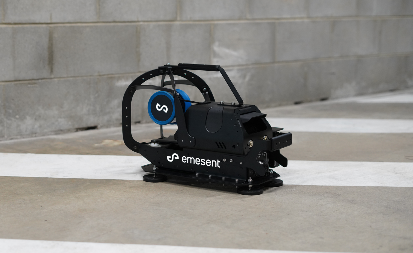


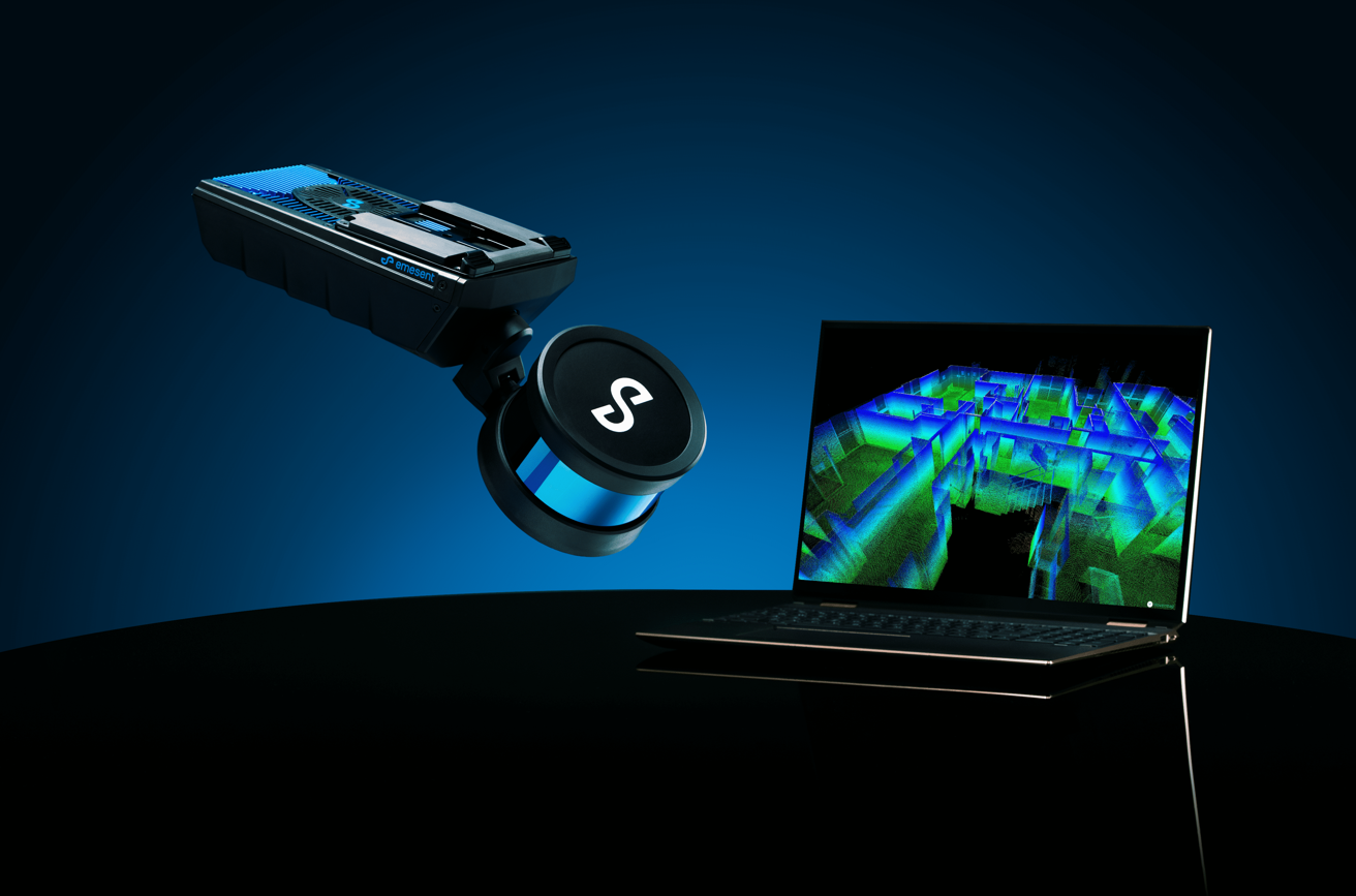
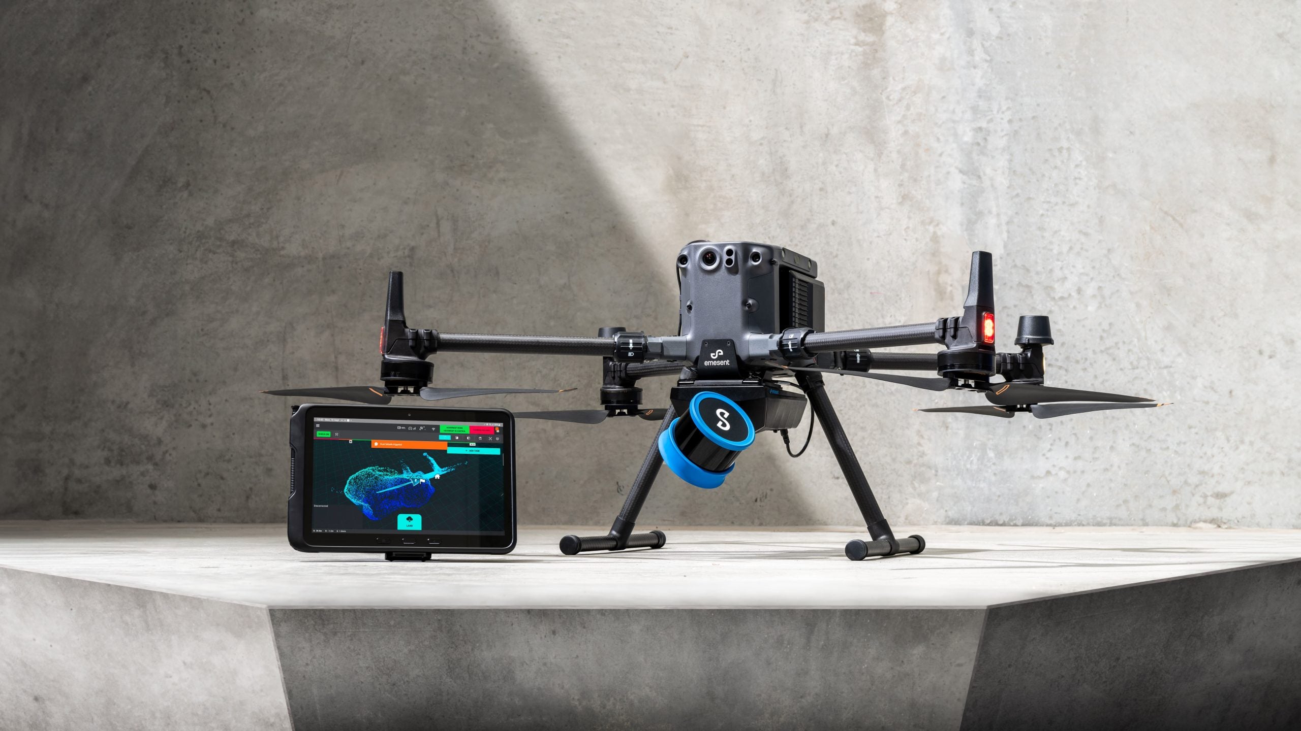
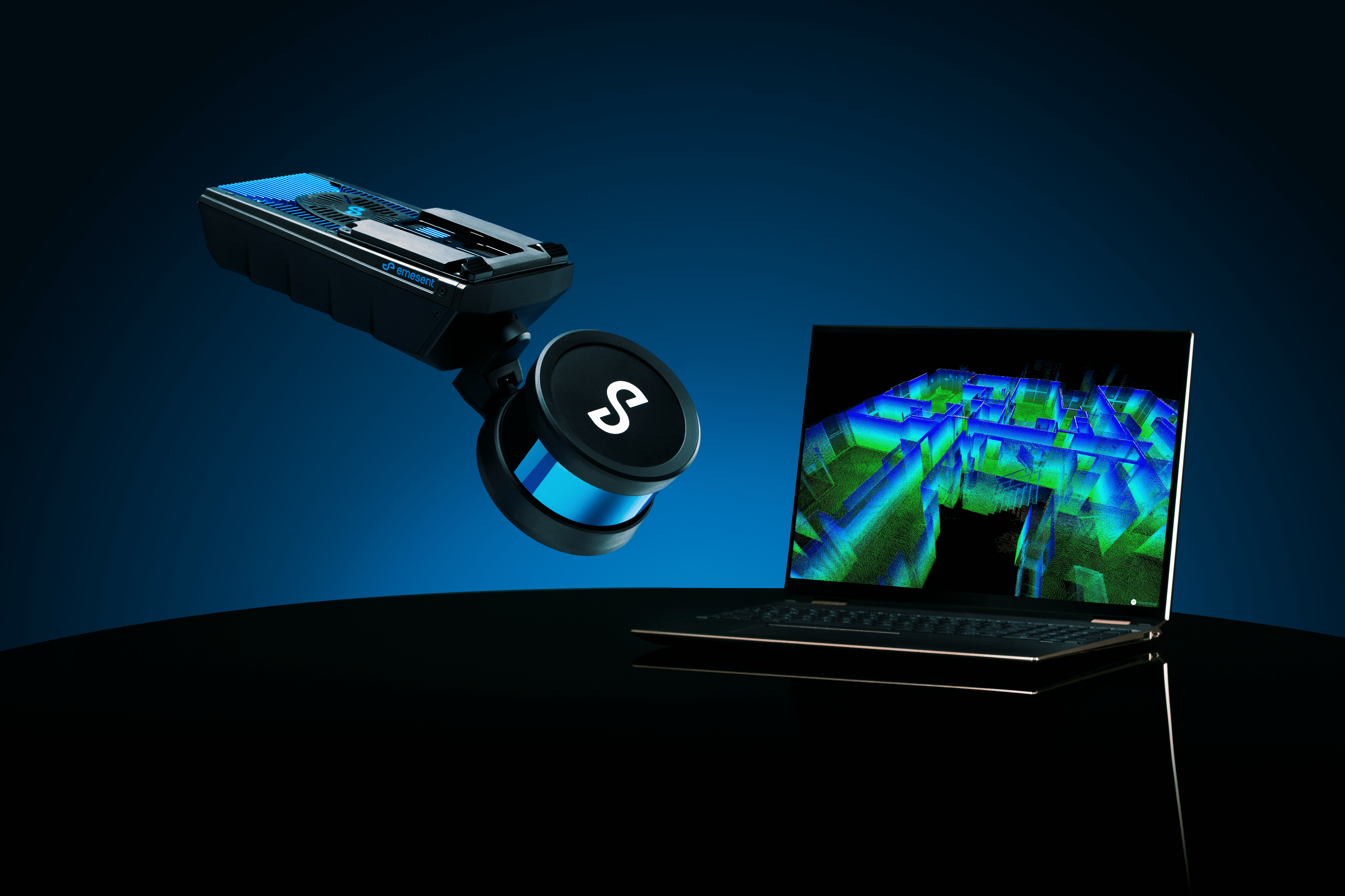
Our flagship product, Hovermap, is a smart mobile scanning unit that combines autonomous flight and advanced collision avoidance technologies to map hazardous and GPS-denied environments.
Its award-winning technology utilizes innovative hardware, advanced algorithms and machine learning to automate collection and analysis of the physical world. Equally capable above ground or underground, indoors or out, Hovermap is a complete mobile LiDAR mapping solution.
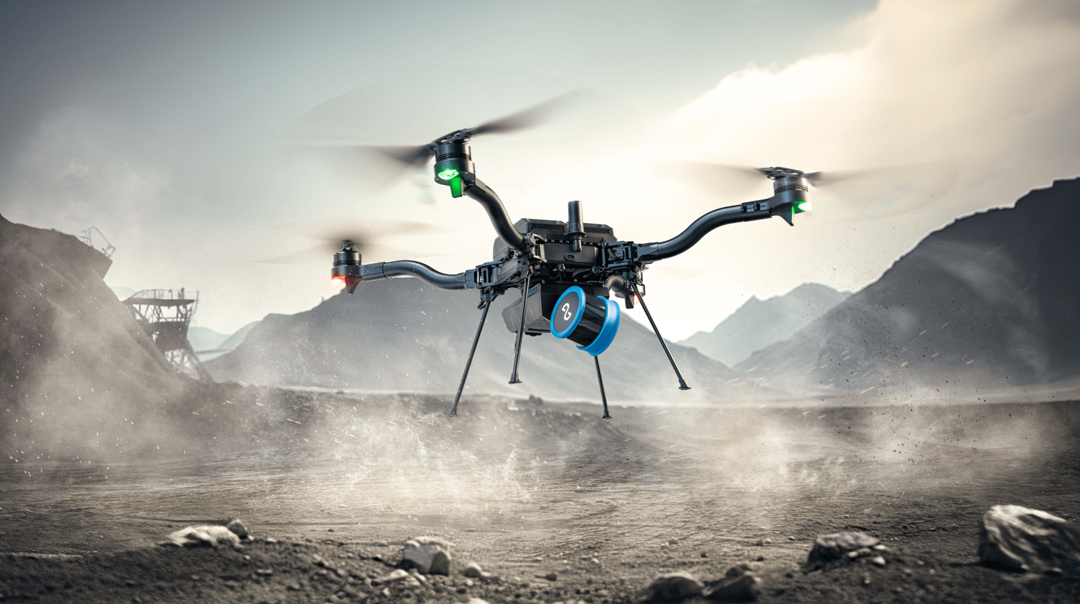
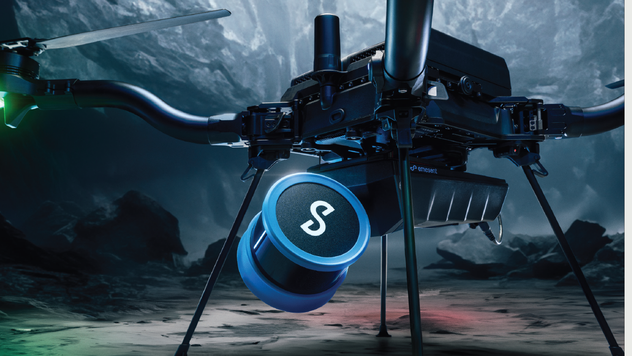
Hovermap is uniquely versatile. Designed with a plug and play quick-release mechanism that allows for easy switching, it can be used as a handheld scanner or mounted to a drone, vehicle, backpack, or pole to map challenging and inaccessible areas.
This means our customers are now able to gain insights that were not possible before. With multiple applications across several industries and a rapidly growing customer base, Hovermap and our other solutions are being used commercially for a variety of applications by enterprise customers around the world.

Rio Tinto engaged LiDAR specialist MINELiDAR to demonstrate an improved method for convergence monitoring.
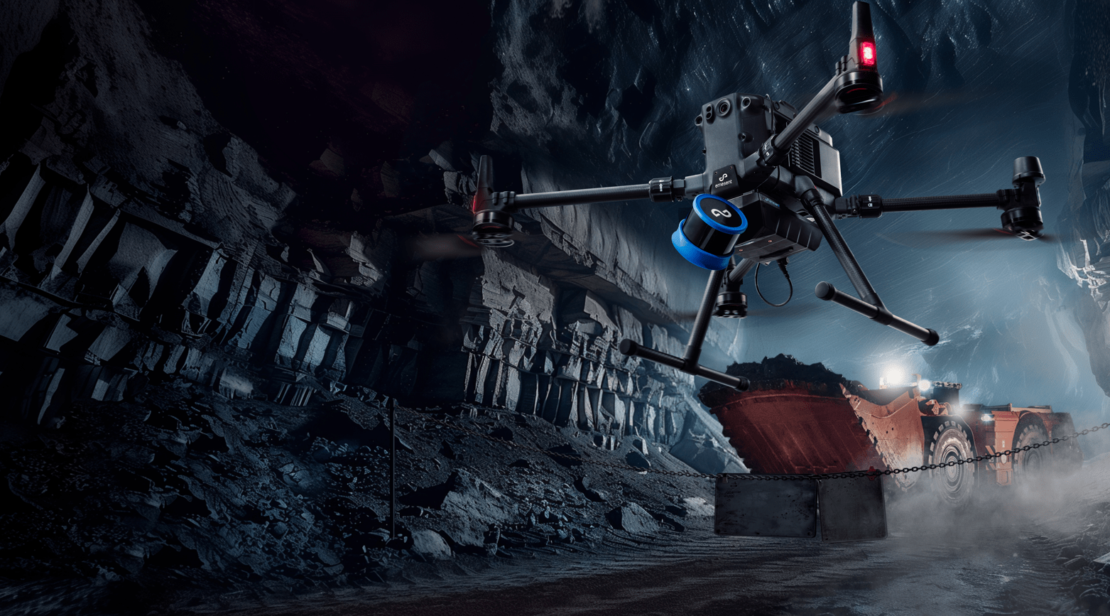
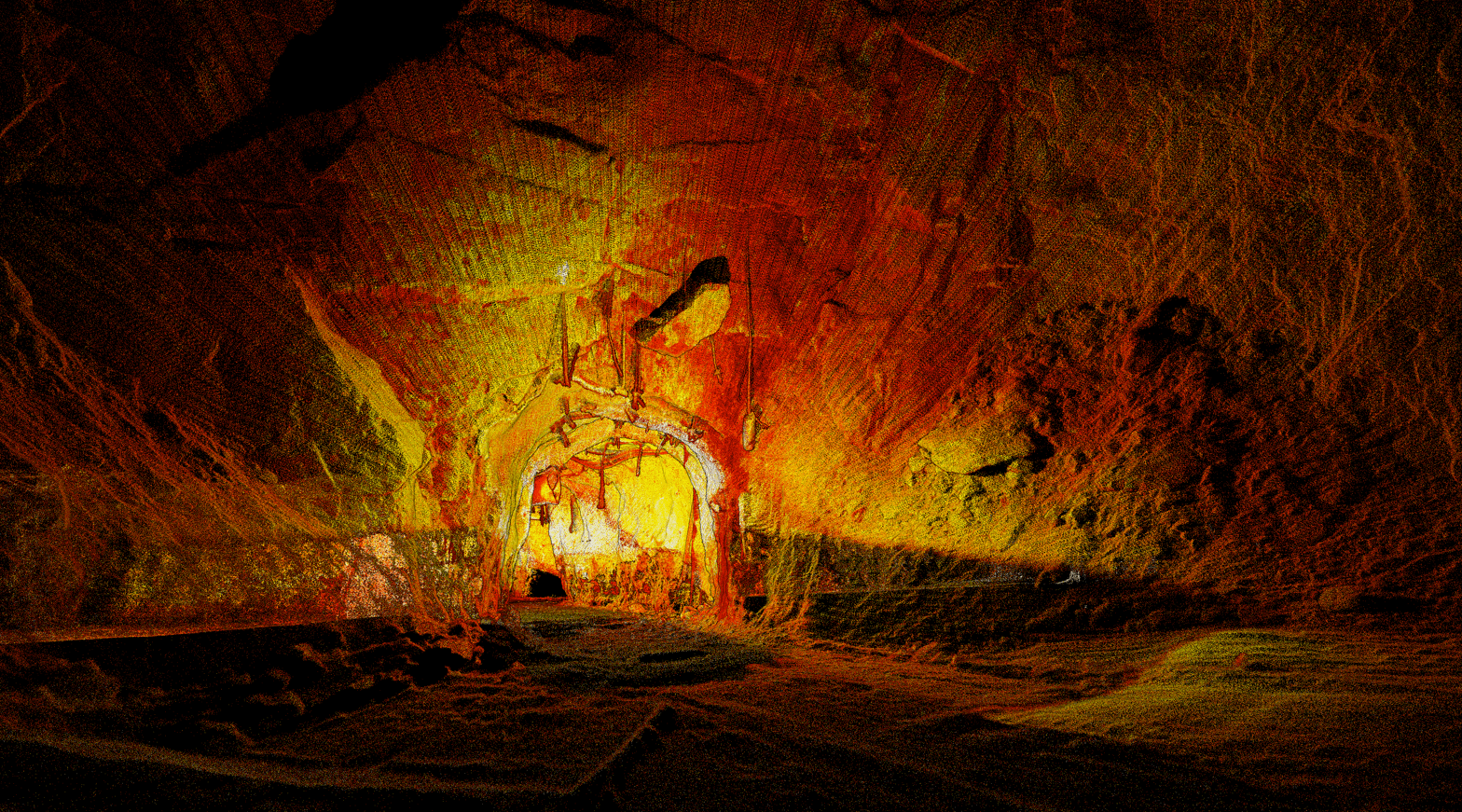
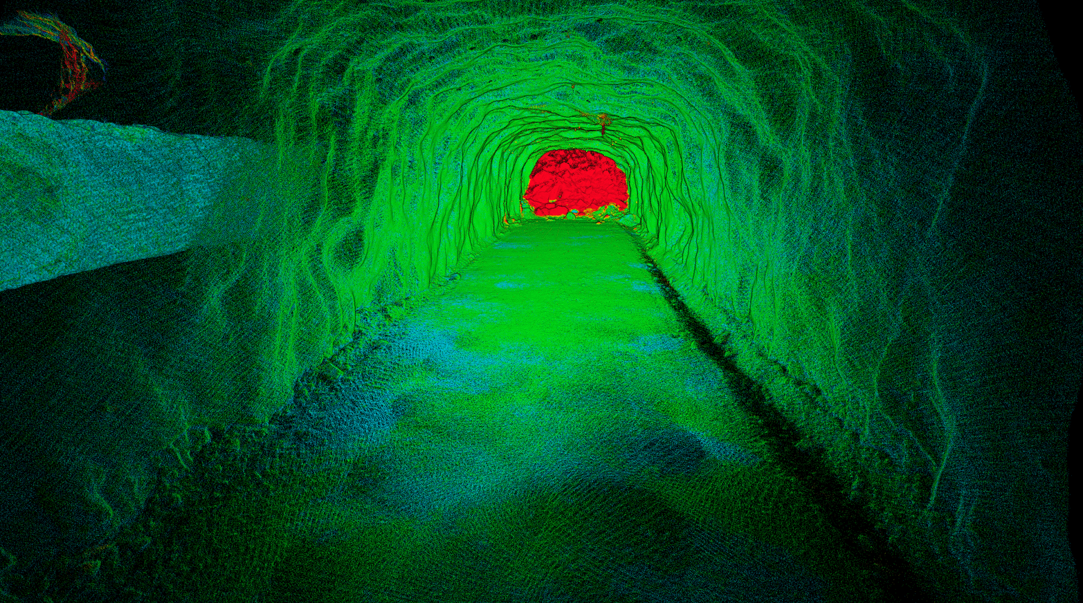
Hovermap is a SLAM-based LiDAR mapping system. It enables data capture of critical underground mine excavations and captures new insights to optimize mine development and operations.
BHP’s Olympic Dam (OD) mine was an early adopter of Emesent’s Hovermap mobile LiDAR system. First deployed in February 2019, Hovermap has become a ubiquitous tool that’s integral to the mine’s underground operational workflows. Geotech, engineering, geology and survey teams use data captured by Hovermap from stopes, orepasses, drawpoints and other underground infrastructure.
Are you monitoring convergence as often as you should be? Are you able to monitor for change across your entire excavation? Are you able to predict where things may change dramatically?
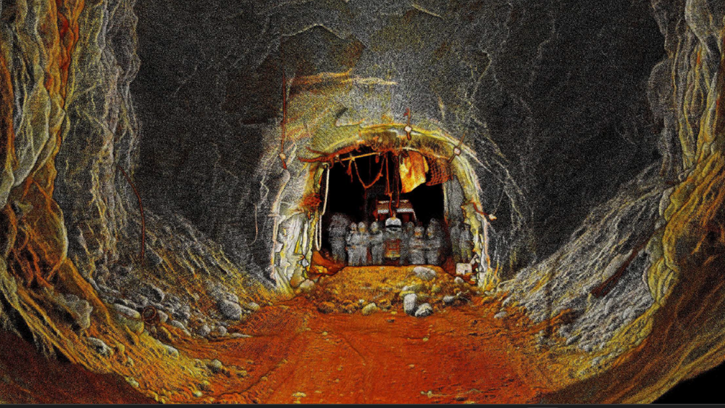
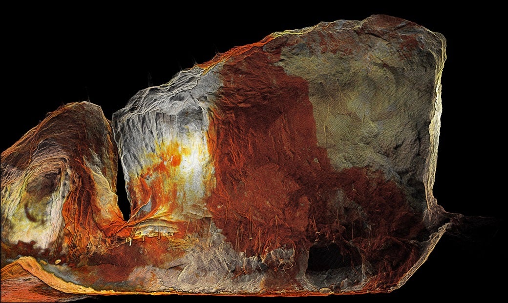
In underground mining, accurately and efficiently assessing the geometry and volume of mined stopes is essential to optimize production, monitor stope integrity and evaluate the quality of mined ore. However, access to voids is often restricted, hazardous, or prohibited, and the ability to obtain accurate and comprehensive data for timely decision making is a challenge.
Offering a uniquely versatile mine mapping solution, Emesent Hovermap enables safe and efficient site surveying in stopes and vertical shafts, helps monitor convergence in drifts, enhances visibility for LHD operations, builds an accurate, up-to-date picture of inaccessible areas, and provides the actionable data for many below and aboveground use cases.
Emesent, a global leader in autonomous digital mapping, has passed a major capability milestone with the most significant upgrade yet of its autonomous mapping technology.
Emesent, a global leader in autonomous digital mapping, has launched a new solution for identifying and monitoring underground mining displacement and rock movement.
Emesent, makers of the award-winning Hovermap LiDAR mapping and autonomy solution, has partnered with Pointerra, developers of Digital Twin visualization, collaboration and analytics platform Pointerra3D, to view, share and derive insights from Hovermap point clouds online.

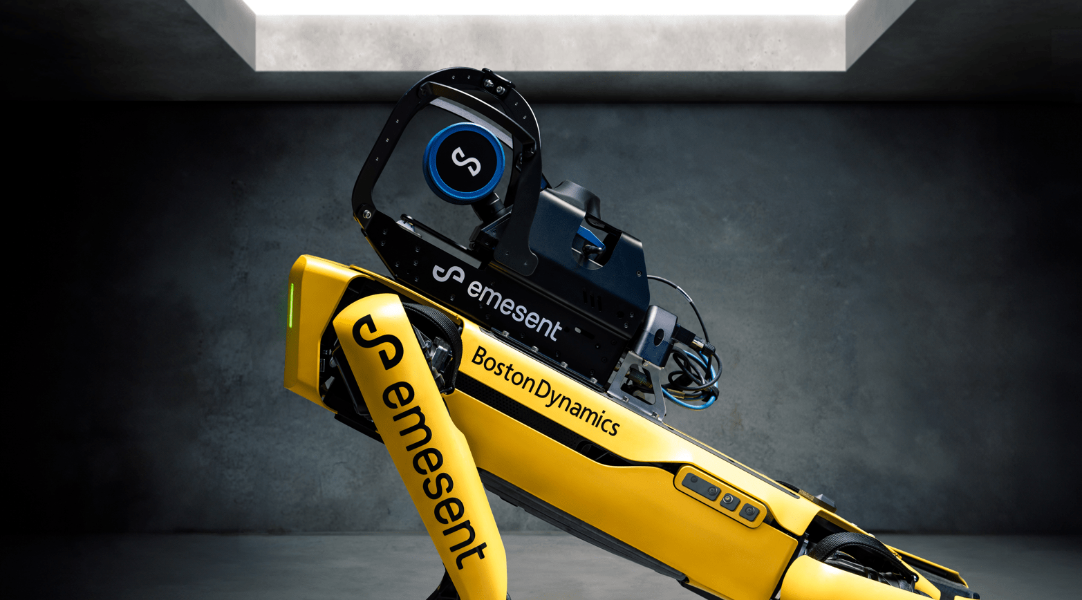
World leader in autonomous drone mapping technology, Emesent, has further progressed its vision for mapping the inaccessible by launching Hovermap integration with the Boston Dynamics Spot agile robot.
Emesent, the Australian makers of the award-winning Hovermap LiDAR mapping and autonomy payload, have responded to US regulations banning Chinese drones by announcing support for the American made Freefly Astro drone.
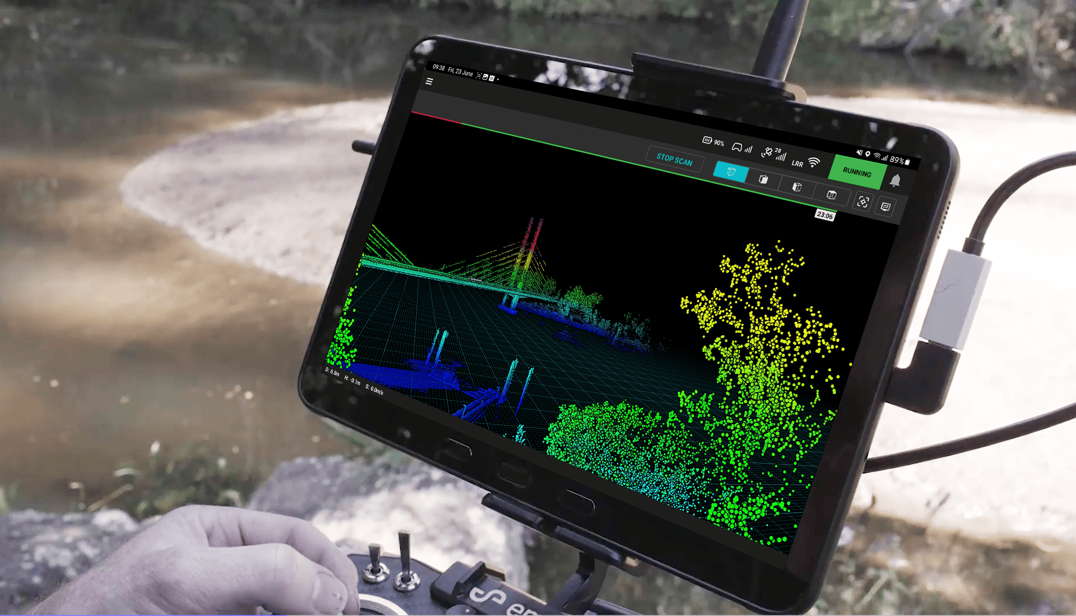
Unlock the power of cutting-edge LiDAR sensing technology with Hovermap, the ultimate solution for high-density point cloud generation with exceptional coverage.
Emesent Commander redefines mission control for Hovermap, offering seamless integration of mapping, pilot assist, and autonomous mission planning and control.
Aura software comes bundled with all Hovermaps, so you can unlock the full potential of your Hovermap scans.
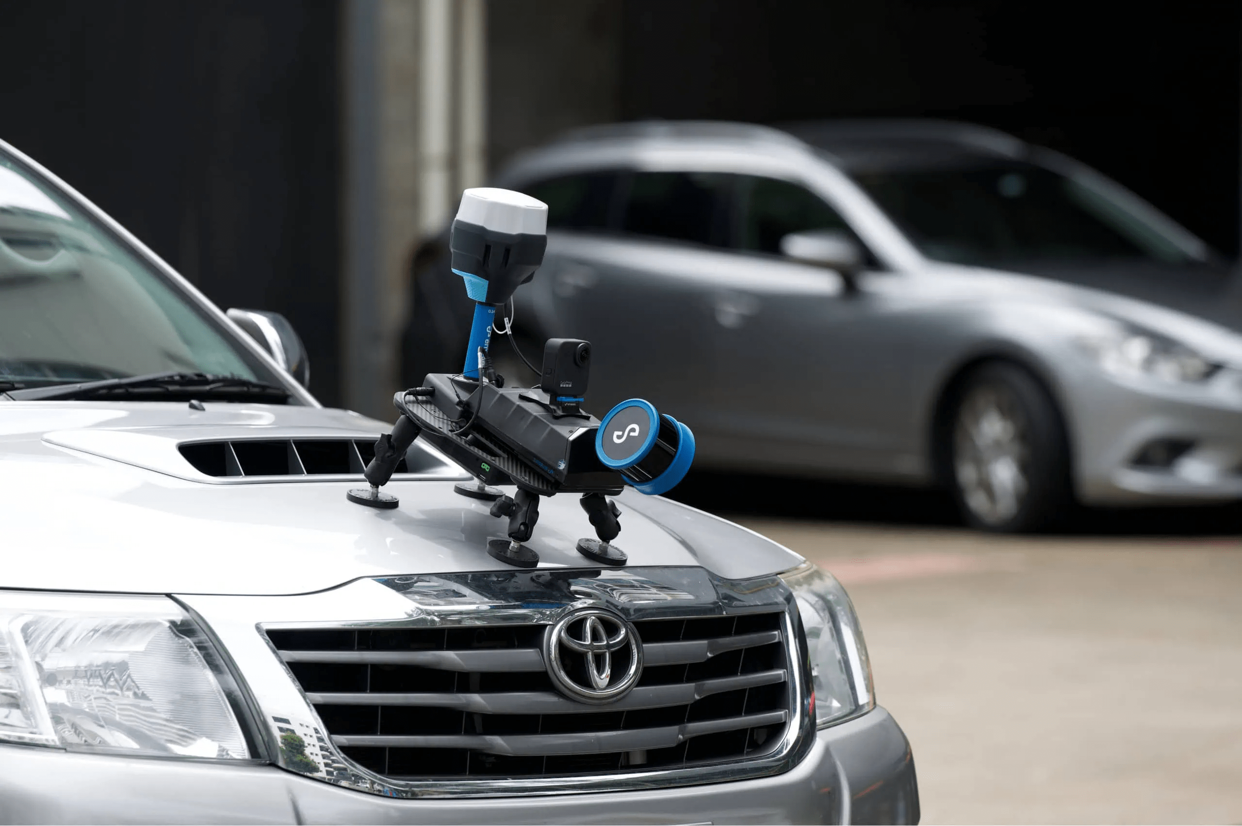
Emesent’s Vehicle RTK delivers confident scanning over large areas and of long, linear assets without the need for GCPs.
Emesent’s Hovermap LHD solution enhances underground mine production by providing near real-time visibility to LHD operations, significantly reducing accidents and incidents.
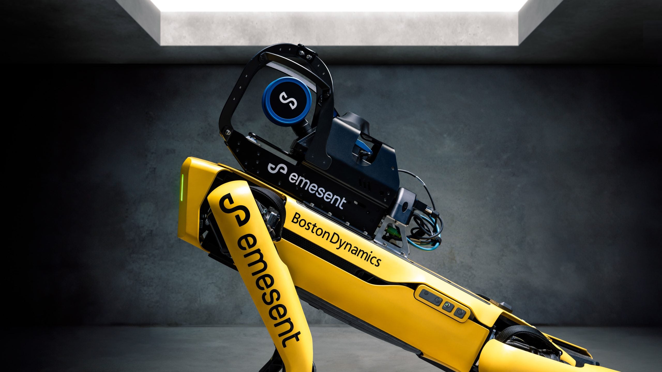
Emesent Hovermap extends Spot’s autonomous navigation and remote mission planning capabilities with continuous SLAM-based LiDAR mapping - increasing efficiency, simplifying workflows and improving safety.

Emesent’s 360 Image Kit for Hovermap enhances the visual context of point cloud scans by adding 360 panoramic photography.
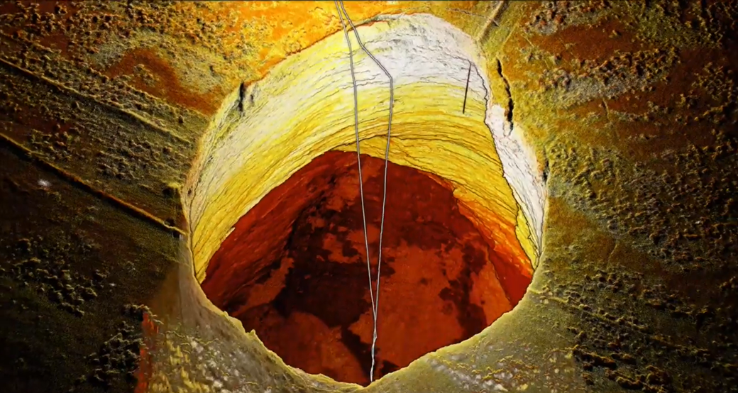
The Carrapateena mine in South Australia, one of the largest copper reserves globally with an annual production of 4,25 million tonnes, employs the sublevel caving mining technique and faced a growing 5m diameter hole at the surface in 2023.
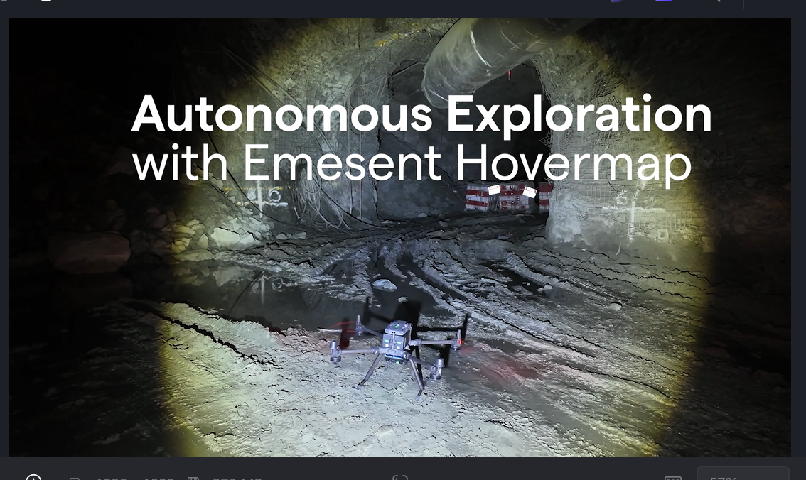
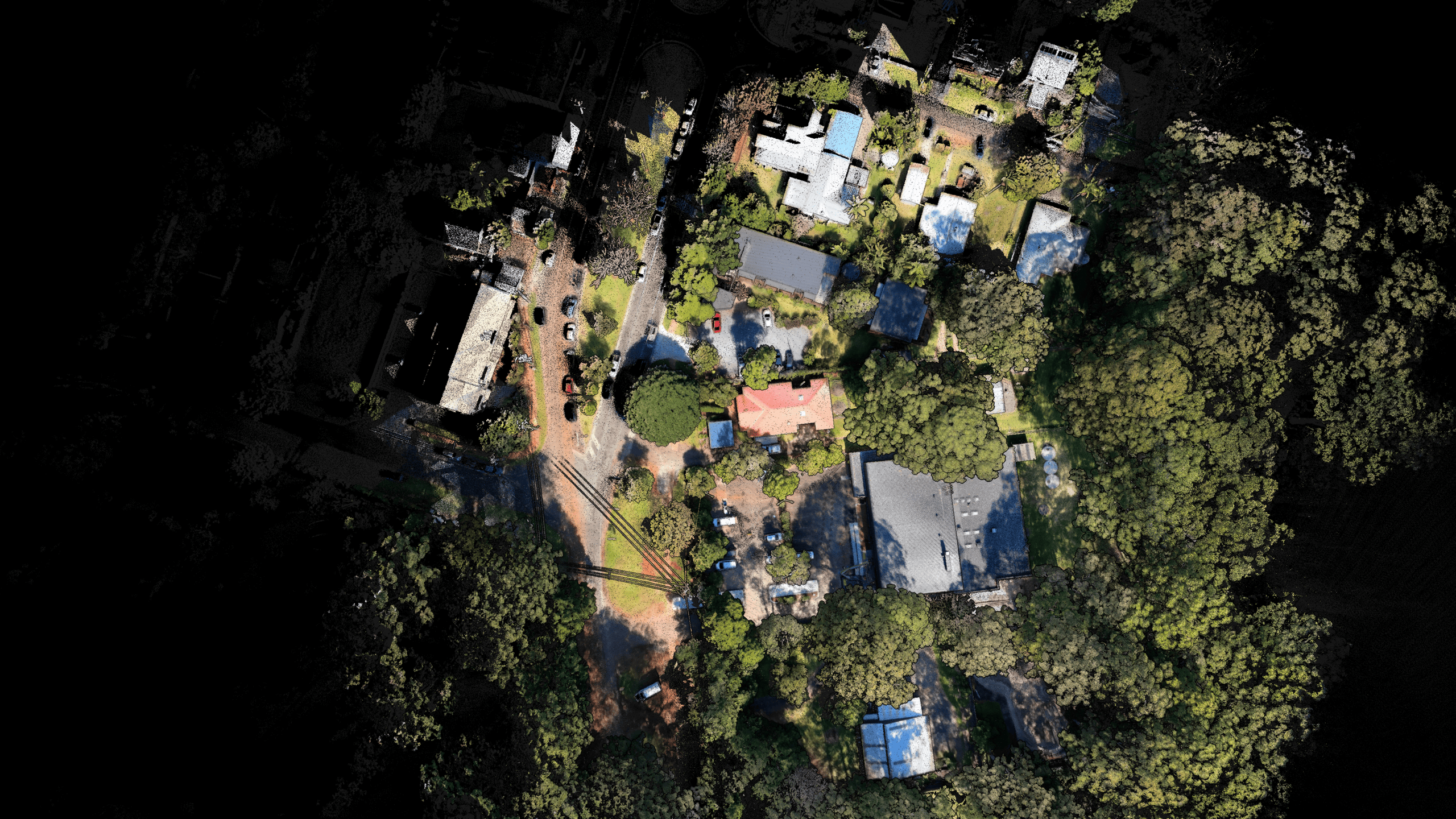
Emesent's Hovermap revolutionizes data capture with its cutting-edge LiDAR technology, enabling fully autonomous exploration and mapping in challenging environments, generating high-density point clouds with a sensing range of up to 300 meters