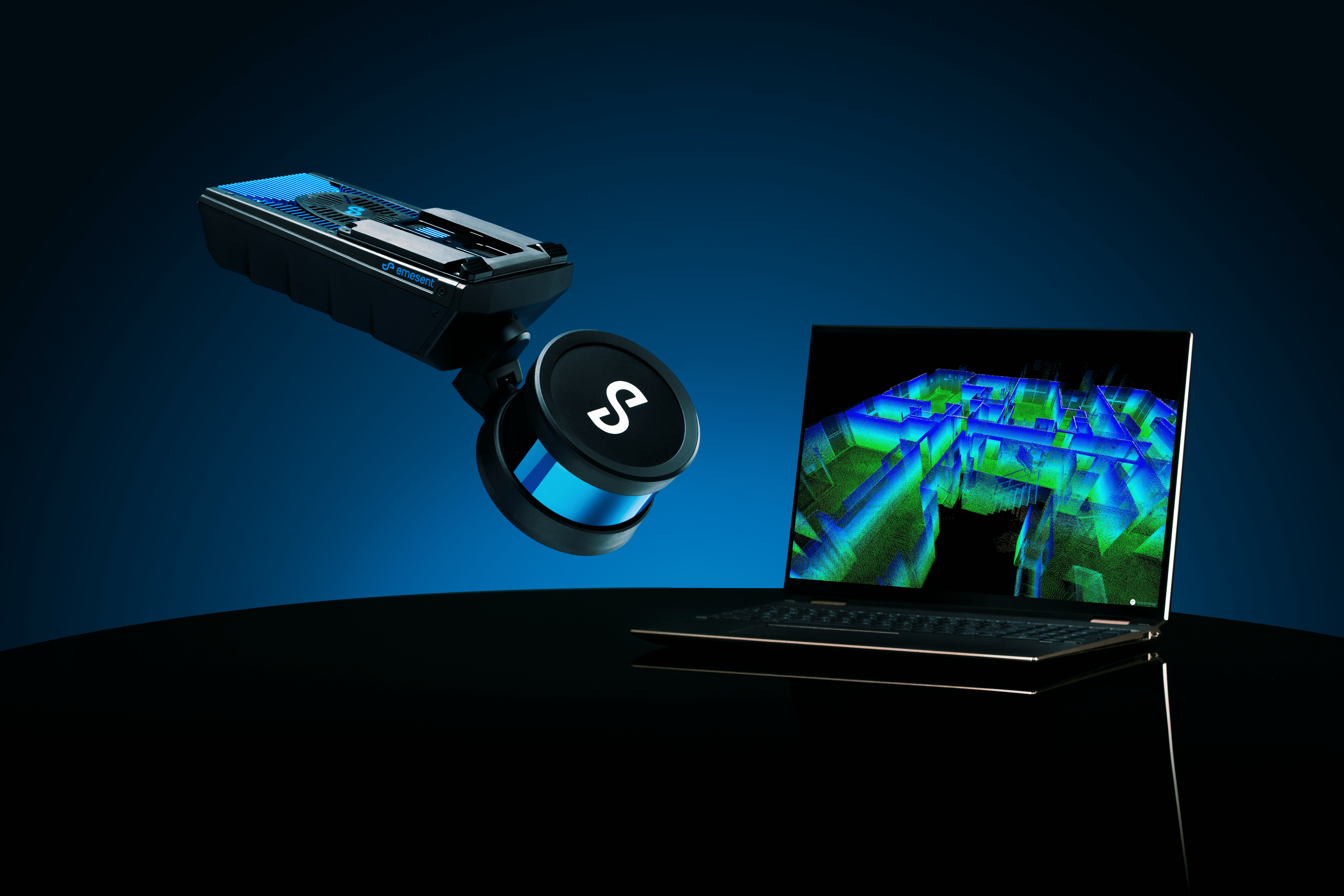
Hovermap
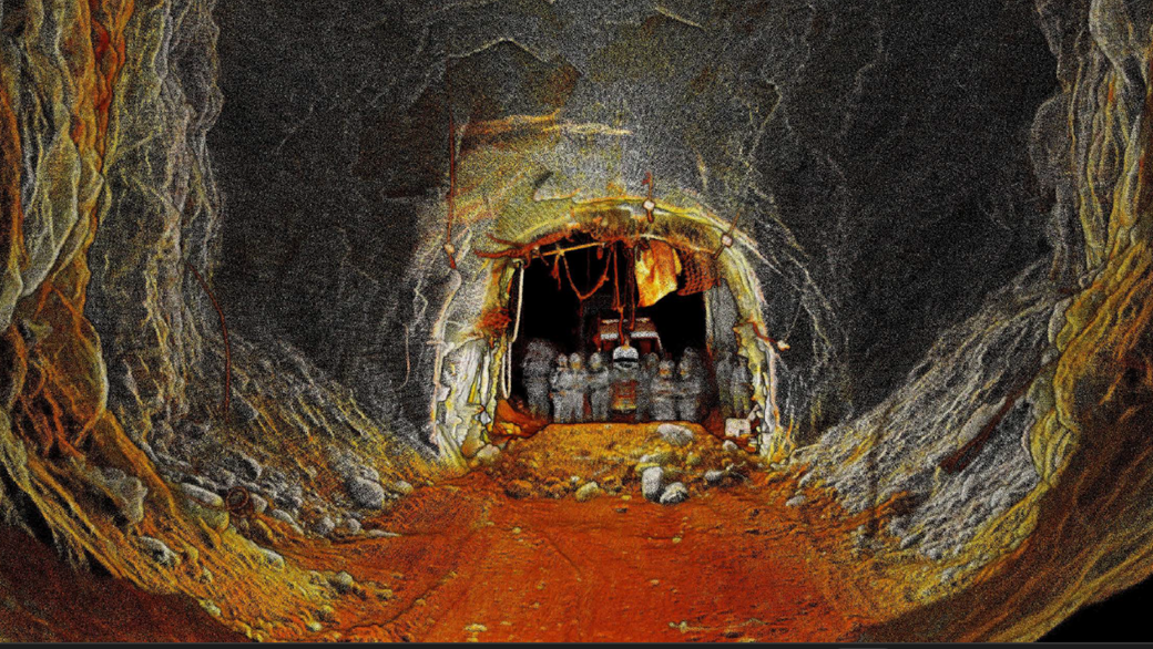
Unlock the power of cutting-edge LiDAR sensing technology with Hovermap, the ultimate solution for high-density point cloud generation with exceptional coverage. Hovermap empowers you to capture detailed, accurate data over vast areas in record time, accelerating your path to valuable insights. With a sensing range of up to 300 meters and the capability to generate over a million points per second, Hovermap revolutionizes data capture and visualization.
Why Choose Hovermap?
Fast Time to Insight: With a LiDAR sensing range of up to 300 meters and triple returns capable of capturing over one million points per second, Hovermap enables you to efficiently capture detailed data over expansive areas in minimal time, maximizing your operational efficiency.
Survey-Grade Accuracy: Benefit from award-winning Wildcat SLAM technology, Automated Ground Control Points, and a high-resolution LiDAR sensor, ensuring sub-centimeter precision for enhanced measurements and insights, setting the standard for accuracy in LiDAR mapping.
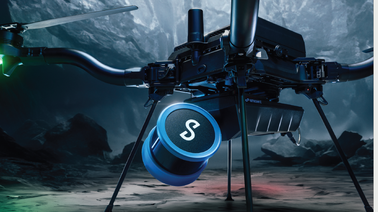
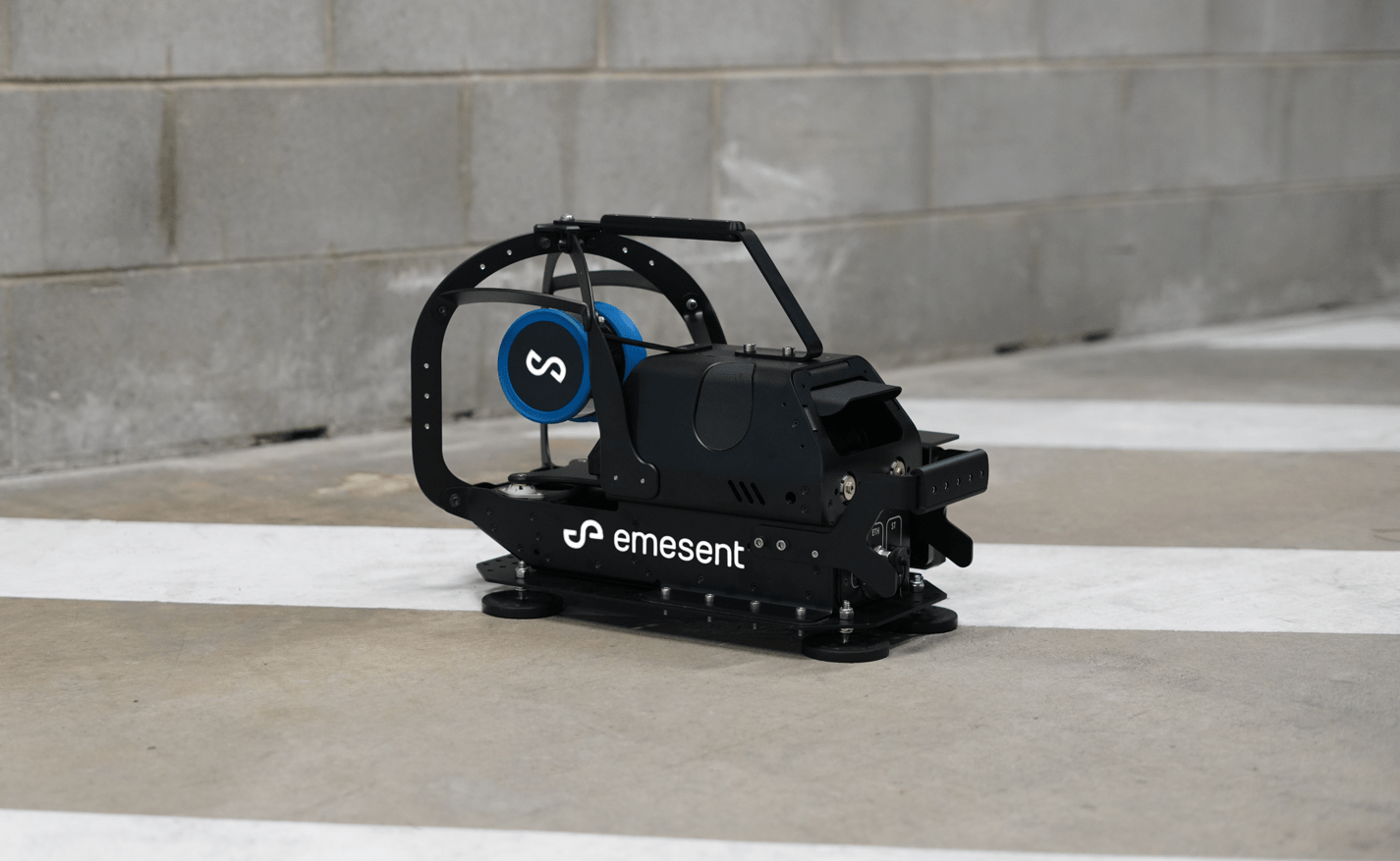
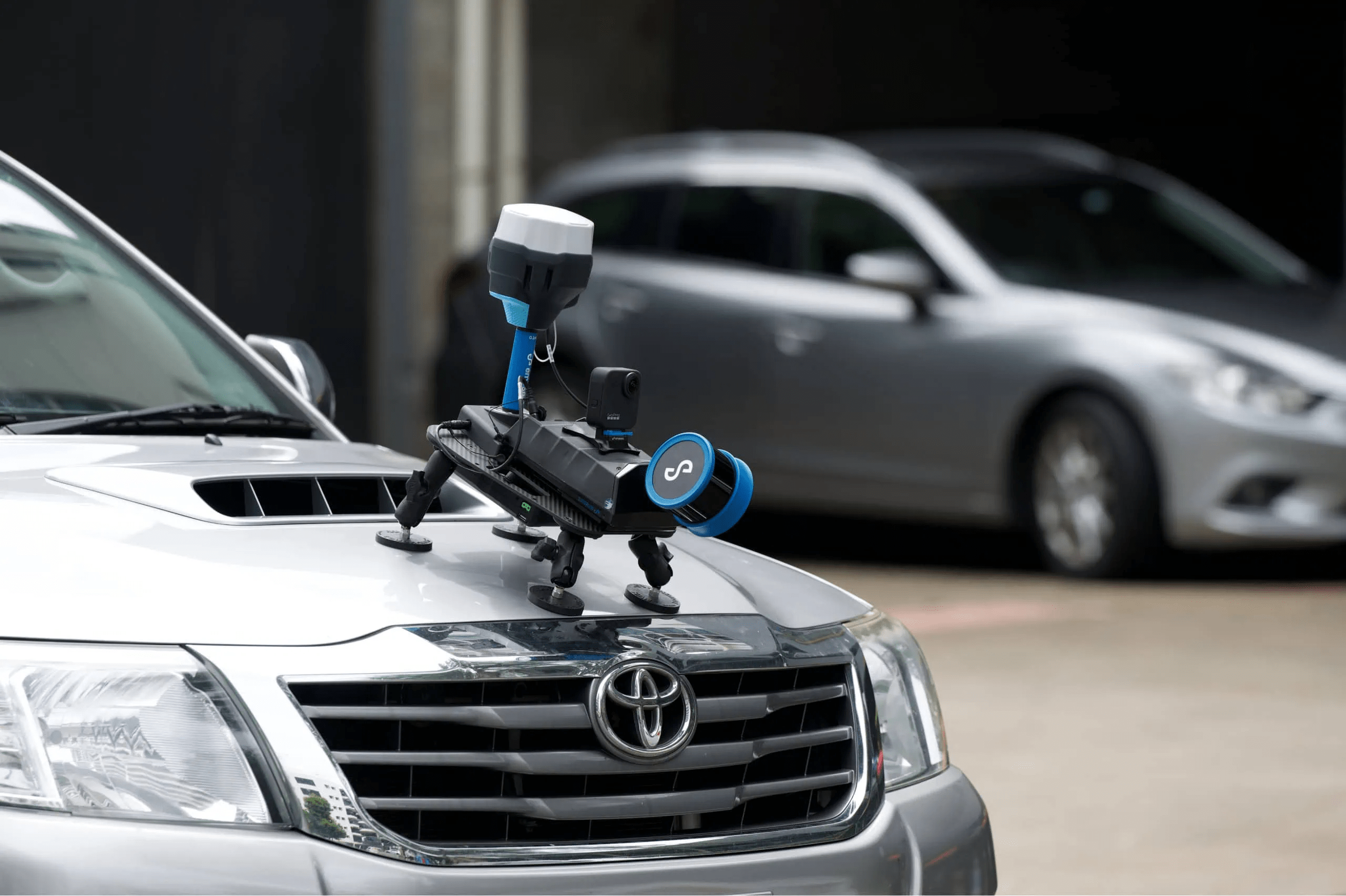
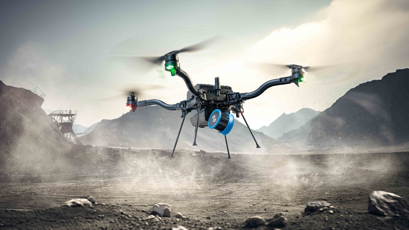
Uniquely Versatile: Enjoy unparalleled versatility with Hovermap’s plug-and-play design and quick-release mechanism, facilitating seamless transitions between scanning modes. Whether handheld, drone-mounted, vehicle-mounted, or deployed in a protective cage or backpack, Hovermap adapts effortlessly to any environment, providing unmatched flexibility and ease of use.
Superior Detail: Capture shadowless, high-quality point clouds with unparalleled detail, revealing rich features and enhancing reality capture with optional colorization, delivering comprehensive data sets for advanced analysis and decision-making.
Mapping Options for Every Need
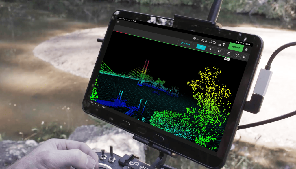
Hovermap offers autonomous waypoint mode for beyond line-of-sight flight, pilot assist mode for omnidirectional collision avoidance and GPS-denied flight, and mapping mode for fast, accurate, and high-resolution scanning. With live streamed point clouds and compatibility with Emesent Commander for effortless mission planning and control, Hovermap ensures seamless operation in any scenario.
Leading LiDAR Mapping
Designed for Tough Missions: Built to withstand harsh environments with IP65 weather sealing, Hovermap ensures reliability in even the most challenging conditions.
Deployment Options: From aerial to ground-based scanning, Hovermap’s plug-and-play design facilitates effortless deployment in previously inaccessible areas.
Robust Autonomy: Enjoy peace of mind with autonomous modes tailored to your needs, ensuring safe and efficient data capture.
Live Streamed Point Clouds: Monitor data capture in real-time with live streamed point clouds via the Hovermap app, enhancing situational awareness and facilitating immediate decision-making.
Designed for Fleet Expansion: Compatible accessories streamline fleet management, allowing seamless integration of additional Hovermap units.
Automated Mission Control: Emesent Commander simplifies mission planning and control, offering intuitive operation and access to advanced autonomous capabilities.
Point Cloud Processing: Utilize Emesent Aura for streamlined processing and visualization of point clouds, enabling faster insights and improved decision-making.
Don’t miss out on the future of mobile data capture. Choose Hovermap and unlock limitless possibilities for data-driven decision-making.