
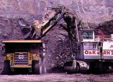
Geita Open-Pit Gold Mine, Mwanza, Tanzania
The Geita open-pit gold mine is currently served by a 5.1Mtpa carbon-in-leach (CIL) processing plant.
You have successfully submitted your enquiry. Someone from our company will respond ASAP
3D Laser Mapping specialises in high-specification laser scanning systems for monitoring mine safety and activity. The company’s fixed and mobile laser systems provide a continuous electronic eye to automatically monitor mines 24 hours a day. The systems provide significant improvements in mine safety and automatically map and measure production. A live, online reporting capability provides remote support and monitoring from anywhere in the world via the Internet.
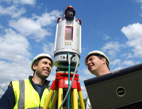
With specifications that other monitoring techniques cannot achieve, laser scanning opens up a whole new dimension in monitoring. 3D Laser Mapping employs the latest long-range laser scanners, which can capture up to 11,000 point measurements per second, to an accuracy of 10mm and at a range of up to 6,000m.
3D Laser Mapping’s SiteMonitor fixed laser-scanning system is designed to measure and monitor the stability of rock faces and slopes to improve mine safety. An Internet reporting service allows operations to be remotely monitored in real time from any location in the world.
SiteMonitor also monitors and helps optimise production by generating a digital terrain map of the mine that can be used to continually measure extraction or fill rates and volumes. An analysis module allows data analysis and interpretation, including 3D viewing, automated cross-section production and the graphical display of measurements over a set time period.
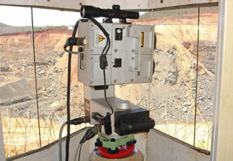
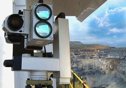
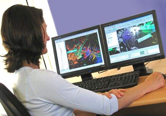
3D Laser Mapping’s range of mine safety monitoring equipment includes SiteMonitor analysis software, which tracks and compares displacement measurements over time. It features an alarm module that can be programmed to monitor recordings for unexpected or unusual measurements. This provides an early warning of abnormal movement and therefore potential failures in the active mining area that may impact on production, cause damage to equipment or even cause injury to personnel.
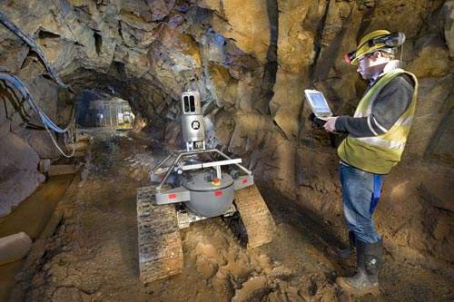
3D Laser Mapping offers a range of mobile, fixed and airborne laser systems that can be used for site surveys, perimeter security, research and exploration. 3D Laser Mapping has, for example, developed an innovative remote-controlled laser mapping vehicle called 3DR1 for use underground where mine entry is unsafe.
Through a worldwide network of distributors 3D Laser Mapping is able to provide frontline support and service for a growing international client base. Using the internet-based support option SiteMonitor data is already being continuously streamed from gold, platinum and diamond mines in Africa to 3D Laser Mapping’s global operations centre in Nottingham, UK.

The Geita open-pit gold mine is currently served by a 5.1Mtpa carbon-in-leach (CIL) processing plant.
BHP Billiton's Spence copper cathode project is located 1,700m above sea level in the Atacama Desert in northern Chile,
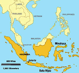
Batu Hijau copper-gold mine is located on the Indonesian island of Sumbawa in the province of West Nusa Tenggara, 1,530k
Debswana is the world's leading producer of gem diamonds, contributing about 30% of world output by value from four mine
The Porgera gold mine is located in Enga Province, about 600km north west of Port Moresby. The mine is operated by a joi
The largest coal mining operation in Latin America, Carbones del Cerrejón Norte was developed by a joint venture between the Colombian state organisation, Carbones de Colombia (Carbocol) and Intercor, a subsidiary of the US energy company ExxonMobil.
3D Laser Mapping has appointed Jon Chicken as managing director. Jon will take on responsibility for the day-to-day running of the Nottingham-based supplier of laser scanning hardware and software and will manage the company's continued worldwide expansion.
3D Laser Mapping has expanded its sales operation with the appointment of Jon Chicken to the position of sales director. Operating in the UK and across mainland Europe, Jon will be responsible for managing growth in sales of laser scanning hardware, software and systems including the world's most
Global Geomatics is set to revolutionise the survey market in Africa following the purchase of a StreetMapper mobile laser mapping system. It is the first system of its kind to be operational in Africa and will provide Global Geomatics with a competitive advantage with a world-leading rapid surve
3D Laser Mapping is proud to announce that the company's laser mapping technology is being employed to predict avalanches in the Himalayas. The SiteMonitor laser monitoring system, developed by 3D Laser Mapping and first used to monitor gold mines in Africa, is being distributed by Elcome Technol
3D Laser Mapping has launched an innovative laser-based mine monitoring solution. SiteMonitor Mobile combines the flexibility of a mobile mapping system with the performance and accuracy of a fixed laser monitoring solution. It is designed to improve site safety and increase production and offers
3D Laser Mapping has opened a new global headquarters near Nottingham, UK, following continued expansion of its worldwide laser scanning business in the mining sector. This relocation to larger premises will allow for development of a dedicated research and development facility together
3D Laser Mapping, the international developer of laser scanning solutions, has appointed Francois Stroh to the position of global mining product manager. Stroh, an engineering surveyor with more than ten years experience of laser scanning sales, installation, training and support, will
3D Laser Mapping has delivered an advanced laser scanning system to help monitor the construction of a new gold mine in the Dominican Republic. Selected by the Pueblo Viejo Dominicana Corporation the laser scanner will be used to record construction in the process plant, calculate volumes of
3D Laser Mapping has appointed CPE Technologia to act as a reseller of SiteMonitor, the specialist mine safety monitoring system. Founded in 1974, CPE has established a reputation as a leader in the leasing and sale of surveying equipment in Brazil, and offers a wealth of experience and expertis
GEO-10 combines a trade exhibition that has seen some of the most significant product launches and announcements over its 12-year history. With two days of conference, a packed programme of free, show-floor seminars, live product demos and of course great networking opportunities, including a La
3D Laser Mapping has appointed GEOCOM to act as Chilean representative for its high-tech laser scanning systems. With over 20 years’ experience in providing advanced solutions for field surveying, GEOCOM was the obvious partner for the region. Chile is a vital area for mining and econ
Mining operations in East Africa are set to benefit from the latest laser mapping technology following the purchase of a high-specification laser scanner by Kenyan firm Ramani Geosystems. Supplied by UK-based 3D Laser Mapping, the Riegl LMS Z420i scanner can map the terrain in 3D up t
Nottingham, UK - A revolutionary laser scanning robot has been used to create a highly accurate 3D model of an historic tin mine in Cornwall. Developed by Jobling Purser RSV with support from 3D Laser Mapping, the robot, 3D-R1, utilises the latest laser scanner hardware combined with
3D Laser Mapping has launched a new safety monitoring system that automatically detects tiny movements in slopes and walls in open pit mines. Using advanced laser scanning technology, the modular SiteMonitor 3 system offers extensive user-defined alarm options with remote monitoring over the inte