Skip to site menu Skip to page content

20+ Ways To Use Hovermap In Underground Mining

By Emesent
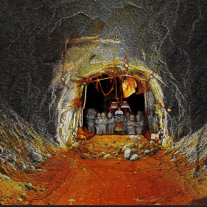
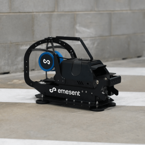
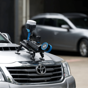
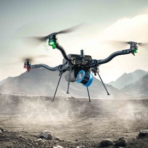
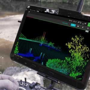
Hovermap is a SLAM-based LiDAR mapping system. It enables data capture of critical underground mine excavations and captures new insights to optimize mine development and operations. When mounted to a drone, Hovermap enables autonomous flight (AL2) beyond line-of-sight and communication range, in hazardous, GPSdenied environments. Operators can capture high quality data from inaccessible underground voids and use it to inform their decisionmaking, while personnel remain safe under controlled ground.
Enter your details below to view the free white paper

By downloading this whitepaper, you acknowledge that GlobalData may share your information with our white paper partners/sponsors who may contact you directly with information on their products and services.

Visit our Privacy Policy for more information about our services, how GlobalData may use, process and share your personal data, including information on your rights in respect of your personal data and how you can unsubscribe from future marketing communications. Our services are intended for corporate subscribers and you warrant that the email address submitted is your corporate email address.

Related Content