CORALIS helps miners during the entire mining cycle to achieve substantial productivity gain and operations efficiency. With CORALIS, you can estimate, plan and manage your mineral resources using powerful 3D modeling and monitoring software or through our expert services. CORALIS solutions are customised to your needs and suited for mining operations, quarries, waste and tailings management and other types of earthwork projects. Since 1988, our team of engineers, geologists and IT specialists have created user friendly information systems and provided expert services to support miners of all types and sizes.
Customised Mining Software
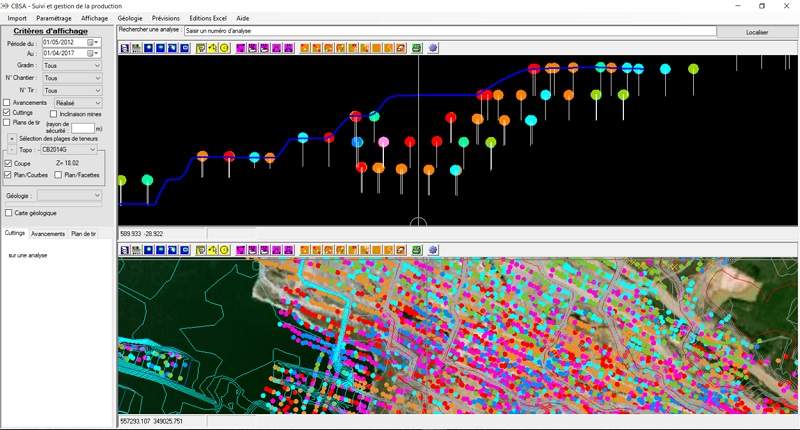
Standard CORALIS Software includes resource and reserve estimation; topographic and geological modeling and monitoring; survey data management; pit, roads and dump design; grade control; production monitoring; environmental, health and safety management; land asset management and more.
Your operations management structure being unique, our standard software can be adapted to fit your needs, including data import and export to and from other software and equipment. So we can complete your existing information system without having to replace everything. This customisation is particularly useful for grade control.
Resource Estimation & 3D Modeling
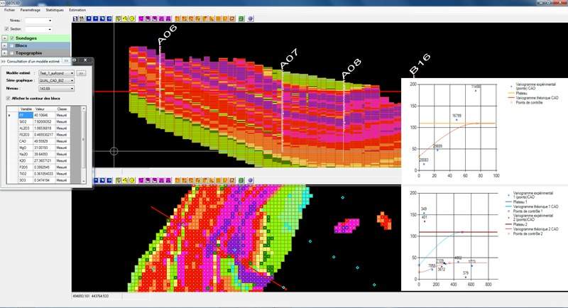
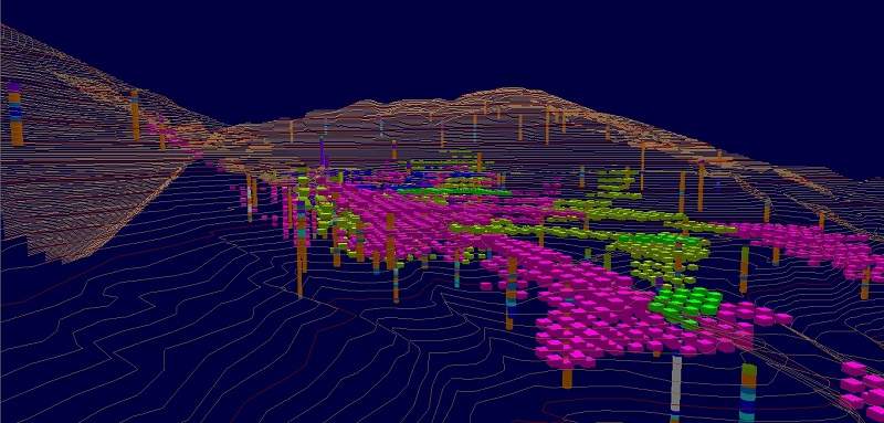
CORALIS Resource and Reserve Estimation module provides a quick and efficient solution to mining professionals who aim to estimate their ore resources and reserves through geostatistical analysis. Combined with the CORALIS Pit Design module, the Block Modeling application estimates all features of an ore body via a 2D or 3D blocks network. Blocks are classified using international resources classification standards such as JORC and NI 43-101.
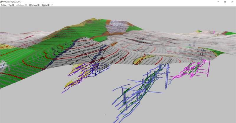
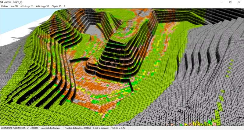
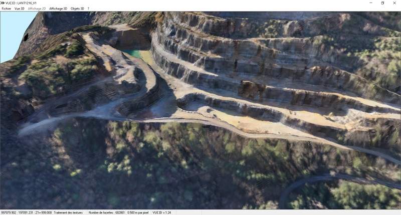
CORALIS topographic modeling manages millions of topographic points in order to model very large areas using terrestrial or aerial surveying data from exchange files (DFX or shapefiles), or from clouds of isolated points.
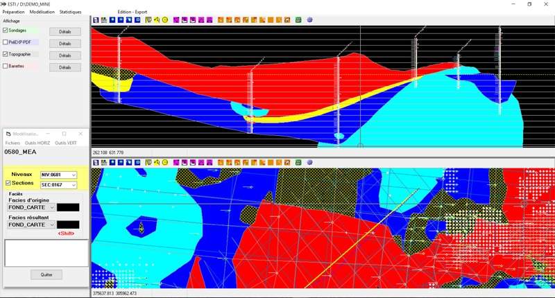
CORALIS Geological Modeling models complex ore deposits using horizontal plans and vertical sections enabling geologists to transfers the different facies from geological drill hole and survey databases. For stratiform deposits, modeling is done for all layers, which are individually delimited by two surfaces calculated from the surveying data.
Mine Planning and Pit Design
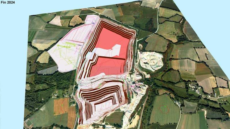
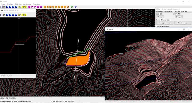
CORALIS Pit Design uses 3D computer-assisted-design (CAD) tools to simulate detailed pit, spoil and dump designs, quickly and efficiently, including ramps, haulage roads and safety berms. Designs use personalized parameters, like slope gradient and bench width. This powerful design tool also produces periodic operational planning reports and it interfaces with the block modeling tool to design the pit around the required quality zones.
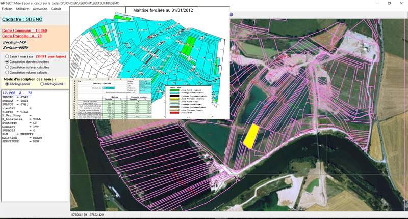
CORALIS Land Asset Management provides a simple and solid solution with related legal and administrative transactions. This geographic information system is organized around a central database; it imports data from the cadastral map and records all information related to the land parcel.
Grade Control and Production Management
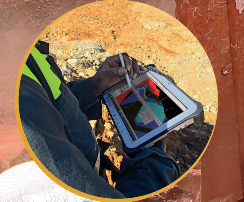
CORALIS Grade Control module brings a quick and efficient solution to miners concerned with final product quality and reserves optimization. Integrated at the heart of the extraction process, it is made of a standard core with customised features, tailored to your needs. It gathers data from the entire operation, from preliminary surveys to geological models, up to final pre-operation surveys, blast-holes or faces sampling. In some cases, CORALIS can use data from production equipment like trucks and excavators.
CORALIS for operations and production management solutions organise data flows coming from mining operations so they can feed the management’s decision-making process, as well as analyse production equipment’s efficiency and their capacity to meet the project’s mid-term and long-term deadlines and objectives. Based on the last available information, CORALIS produces daily schedules so as to meet product grade and tonnage targets.
Site Monitoring / Environmental, Health and Safety (EHS) Management
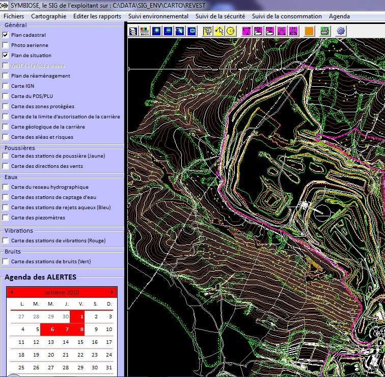
With CORALIS, mining sites are monitored in different ways. CORALIS updates the site’s topography using the last survey data collected on site. Geological Modeling is also updated as often as new data is collected by geologists. Periodic volumetric reports are produced as often as necessary.
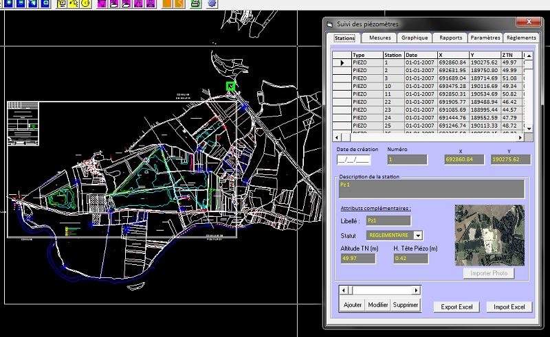
Coralis EHS Management module provides environmental indicators to be monitored and analysed for air quality, water quality, blast vibrations and noise levels. Data is captured from measurement equipment like piezometers, chimneys and filters. Other monitored variables include personnel and equipment security; water, electricity and fuel consumption; and generated waste. Results analysis can be viewed as graphs or reports in MS Excel format, and reminders can be programmed to produce a calendar of scheduled measurements and tasks.
Expert Services
CORALIS had been helping miners for more than 30 years. Our team includes both experienced senior and innovative junior professionals, including mining engineers, geologists, geophysicists, environmental management specialists, programmers and analysts to support users on all five continents, to understand their needs and give them personalized and efficient service. These services include not only customised programming and phone support, but also consulting services (using CORALIS software), which comply with international standards such as JORC and NI 43-101.