CORALIS Grade Control and Production Management

CORALIS Grade Control brings a quick and efficient solution to miners concerned with final product quality and reserves optimization. This module, integrated at the heart of the extraction process, is made of a standard core with customized features, tailored to your needs.
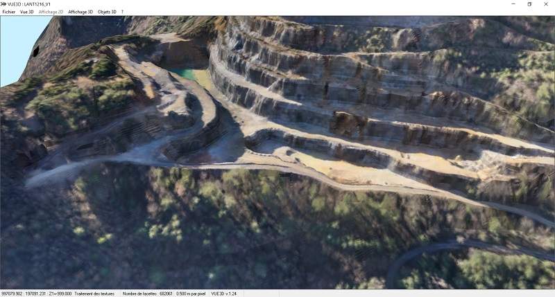
This type of application gathers data from the entire operation, from preliminary surveys to geological models, up to final pre-operation surveys, blast-holes or faces sampling. CORALIS can also use data from production equipment like trucks and excavators or interface with their information systems through data import and export.
Before extracting the mineral, data is collected from surveys, geological models and block models and displayed with the site’s latest topographic data. Blast-holes or faces sampling location originates directly from the GPS equipment; geochemistry results are read automatically from laboratory equipment; and the operator can collect data on site with a tablet.
The user has access to the most precise information possible to make decisions and create the batches of mineral to be extracted within the desired time frame. The operator indicates the grade to be produced and tonnage target. CORALIS produces a list of all areas compatible with production requirements. The user selects the best combinations according to haulage distance while the results table will make possible the deposit’s retrieval optimization. When the product batch is validated, the application updates the corresponding production record and allocate equipment and personnel.
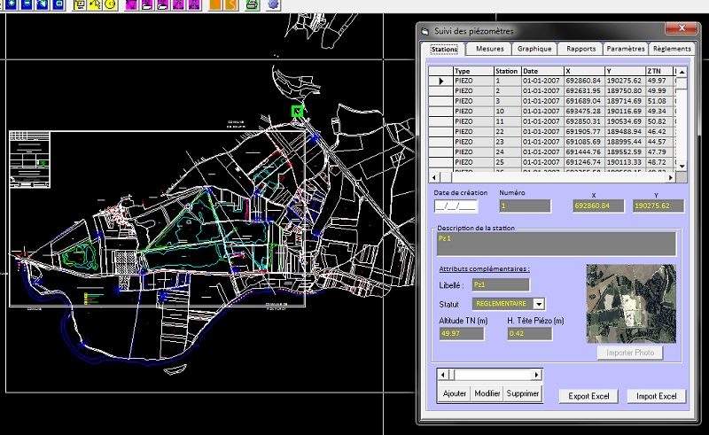
When extraction has been done in the required areas, CORALIS records mined outlines and actual production results (tonnage and grades). CORALIS compiles production results and information necessary to reconcile between models and actual production data. The resulting tables are usually customized to fit your needs.
Underground Geological Monitoring
CORALIS specializes in setting up customized geological control and monitoring systems. These applications are created from Coralis standard applications which are adapted to fit your specific needs.
This application is used on a tablet at the extraction site. Data is synchronized automatically with the office’s central database.
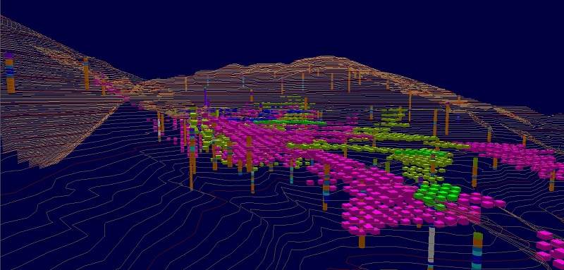
With vein deposits, Coralis software records all tunnel walls sampling in the central database. The geologist notes the sample’s position, the minerals lithology characteristics and other miscellaneous observations using the tablet. When back at the office, the tablet connects to the main server to download the recent data to which will later be added laboratory geochemistry analysis results. Coralis software generates data to be displayed as plan views, cross-sections or 3D view. Sample data can also be used for geological modeling with kriging.
When dealing with complex geology such as lenticular bedding or layered deposits, the model is based on a network of vertical cross-sections and horizontal planes. The geologist analyses the geology from survey data and tunnel walls sampling. Coralis combines lithology, stratigraphy and geochemical data for each drill-hole. The geologist completes the model with a color bar system to insure coherence. Within a few back and forth between cross-sections and planes, the model is completed. Adjusting cross-sections and planes is extra easy and intuitive with basic perimeter operations.