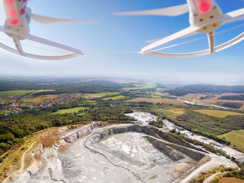
Drone technology has demonstrated a varied range of mining applications from exploration, surveying and mapping to maintaining safety and enhancing security. The popularity of UAVs across the mining industry has grown immensely in recent years, with GlobalData’s survey of more than 200 mine sites showing substantial penetration of drones across regions such as Australasia and Africa.
Listed below are some of the key trends influencing drone development in the mining industry, as identified by GlobalData.
How well do you really know your competitors?
Access the most comprehensive Company Profiles on the market, powered by GlobalData. Save hours of research. Gain competitive edge.

Thank you!
Your download email will arrive shortly
Not ready to buy yet? Download a free sample
We are confident about the unique quality of our Company Profiles. However, we want you to make the most beneficial decision for your business, so we offer a free sample that you can download by submitting the below form
By GlobalDataMonitoring and inspection
Mining is amongst the most unsafe industries for workers, especially those performing deep underground activities. Workers can be subjected to rock falls, extremely humid conditions, gas leaks, dust explosions or floods, amongst other hazards. Therefore, mining companies have used drones at underground mines to monitor and inspect deep underground shafts.
In addition, drones are also being employed for inspection of mining equipment, which is an expensive and time-consuming process requires a highly-skilled workforce. Moreover, the quality of data collected manually may be affected by the very short time allotted to the inspection. Allowing drones to takeover equipment inspections means this task can be performed more efficiently and safely.
Automatic surveying and mapping
Normally, surveying and mapping of mineral landscapes is a time-consuming process. By employing drones and a drone pilot instead of a piloted plane a mine can save around 90% of the cost per hour, and collect unlimited aerial data, including fine measurements by simultaneously capturing high-end orthoimages.
Stockpile management
One of the greatest challenges any mining company faces while managing stockpiles are their extreme height and area, which tends to change frequently. Drones can enable mining companies to generate aerial terrain models of the inventory. Further, deploying drones frequently could ensure companies consistently keep track of stockpile movement.
Effective management of stockpiles could yield significant benefits for mining companies such as grade maximization by blending of ore, production backup during a situation of supply disruptions, and financial reporting.
Haulage road optimisation
The haul road network has a significant impact on the efficiency of mining activities. To achieve safe and uniform transit, the haul road conditions must be constantly monitored. Drones can facilitate this process by collecting a large amount of aerial data, covering wider areas more precisely, which can then be used by engineers for planning, designing, construction and maintenance of haul roads.
Tailings dam management
Utilization of drones to measure tailings dams could eliminate the risk of manual surveying. There is no need for manual interference within the proximity of the dump when drones are around. By analysing the captured data on a digital platform, mining companies can maintain the structural integrity of the tailings dam, design expansion and avoid failure.
This is an edited extract from Drones in Mining – Thematic Research report produced by GlolbalData Thematic Research.


