
GNSS Stations for Deformation Monitoring
Orion Monitoring Systems has delivered high-precision, GPS-enabled deformation monitoring networks for over 15 years.
Orion Monitoring Systems delivers high-precision GPS / GNSS solutions to monitor the deformation of engineered and natural environments.
You have successfully submitted your enquiry. Someone from our company will respond ASAP
Orion Monitoring Systems Inc delivers high-precision GPS / GNSS satellite positioning solutions to monitor the deformation of engineered and natural environments.
Orion provides a single source for satellite-based displacement tracking by offering comprehensive GNSS monitoring systems, consisting of autonomous field stations coupled with network operations software enabled for carrier-phase differential processing.
The company continually develops systems to effectively address real-world monitoring problems in industry such as mine site planning at surface and open pit operations. Past solutions have been implemented via the company’s:
Orion’s software incorporates both kinematic and static GNSS processing in single and dual frequency versions in independent and combined implementations to address the full range of displacement monitoring regimes.
Orion’s roots are in the development of GPS methods for plate tectonic monitoring, but the company’s initial focus was on the application of real-time kinematic (RTK) GPS to monitor the response of long-period structures to seismic events.
During its early years, Orion implemented high-rate GPS with strong motion accelerometers on tall buildings in Los Angeles and San Francisco, California.
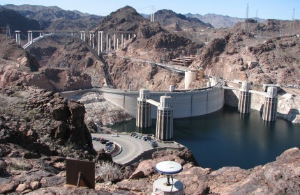
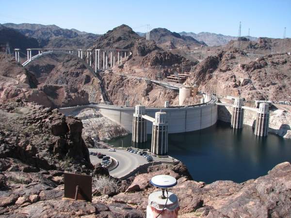
The company then returned to its work on crustal deformation monitoring to implement a system featuring static L1 GPS processing, creating a cost-effective solution to monitor slow-developing deformation. These systems are particularly suitable for dam and slope stability applications in the mining industry.
Orion offers high-precision satellite surveying services, a technology verging on a new age due to the modernisation of existing GPS and GLONASS satellite systems and the ascendance of new constellations in Beidou and Galileo.
Increased satellite counts will enable monitoring at previously inaccessible geomorphic and urban canyons, providing redundant measurements to accelerate the delivery and increase the reliability of ambiguity-fixed positions.
Continued expansion in GNSS board development will continue to decrease pricing, allowing Orion to extend cost-savings and increase network station density for its customers.
In preparation for the coming improvements, Orion has reset its system designs by:
With networks deployed across five continents for over 15 years, Orion continues to provide the most adaptable, cost-effective, GNSS-enabled displacement monitoring solutions to industrial clients.
Orion Monitoring Systems has delivered high-precision, GPS-enabled deformation monitoring networks for over 15 years.
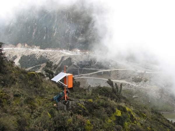
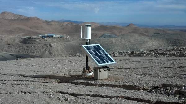
The CAN-GNSS is designed for power supply independence. To support our customers, however, Orion offers several 12VDC power systems packaging 12V battery, charge regulator, solar module and mount in pre-integrated, pre-wired enclosures.