

Managing processes to improve mining risk management and productivity is subject to a large number of complex and varied factors. Internet of Things remote monitoring technologies are becoming increasingly well-suited to handle these complex challenges, offering a range of benefits that improve safety, efficiency, and productivity. Here are some key ways:
Enhanced safety
- Reduced human exposure to danger: by deploying sensors in hazardous areas or automating tasks miners can be kept away from potentially risky situations. This includes monitoring for rockfalls, gas leaks and other environmental hazards.
- Improved situational awareness: real-time data from sensors allows for better monitoring of equipment, personnel, and the overall mine environment, enabling proactive responses to potential issues before they escalate.
- Wearable safety devices: miners can be equipped with wearables that track their location, vital signs, and exposure to harmful conditions, enabling faster response in case of accidents or emergencies.
Increased efficiency and productivity:
- Autonomous operations: remotely controlled and even fully autonomous vehicles and equipment can operate 24/7, improving production capacity and reducing reliance on manual labour.
- Predictive maintenance: sensors can continuously monitor equipment health, enabling proactive maintenance and preventing costly downtime due to unexpected failures.
- Optimised resource utilisation: real-time data on factors like ore grade and equipment performance can be used to optimise extraction processes and resource allocation.
A number of threads run through this trend: IoT hardware tends to be smaller and simpler to use than traditional technologies, it typically costs less and can often enable remote access to numerous datastreams, of varying type, that can be combined to deliver more than the sum of their parts.
The most widely adopted examples in the global mining sector relate to the increasingly sophisticated realm of condition monitoring of plant such as haul trucks, conveyors and crushers. Operators of these capital intensive and critical machines are very familiar with dashboards displaying a suite of data relating to parameters such as temperature, vibration and stress. They rely on these insights to optimize throughput and as the basis of predictive maintenance scheduling. But IoT technologies are equally useful in keeping track of changing ground conditions which can affect the stability of slopes, the integrity of dams and the performance of structures. In this article we look at why these geotechnical applications are growing so quickly.
IoT for Geotechnical Applications
The cost of geotechnical failures can be considerable in terms of financial, safety and environmental impact.
Ground failure events such as the collapse of steep slopes in open pit mines, landslides on dumps and breaches of tailings dams are seldom caused by one factor. They are generally caused by the interaction of numerous factors such as geological structure, water movement and the presence of unstable or low friction layers. It is because there are usually multiple causal factors that it is vital to measure multiple parameters.
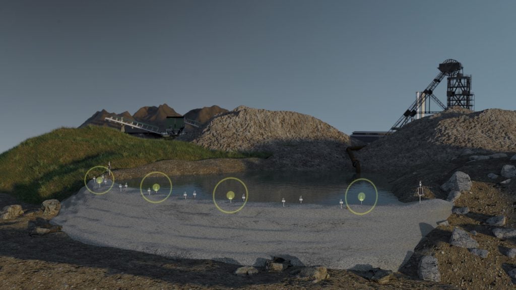
A good example of this is the study of ground deformation and slope risk using a combination of remote sensing technologies such as satellite INSAR and geotechnical instruments such as wireless tilt sensors. Working in this way, geologists or mine engineers can assess the big picture generated by INSAR to select the most relevant places to target in situ measurement technologies. Used in isolation, remote sensing is typically strong on spatial sampling but weak in terms of the frequency of updates and resolution. In contrast, data from in situ methods such as wireless monitoring relates to just a single point in space, but can generate virtually real-time data (sub-minute reporting frequency is quite common). The combination therefore provides a methodology that is robust in terms of both spatial and temporal sampling.
Why combining sensors makes sense
Automation of data collection is crucial if mine operators are to reap the benefits of smart monitoring solutions and digitisation.
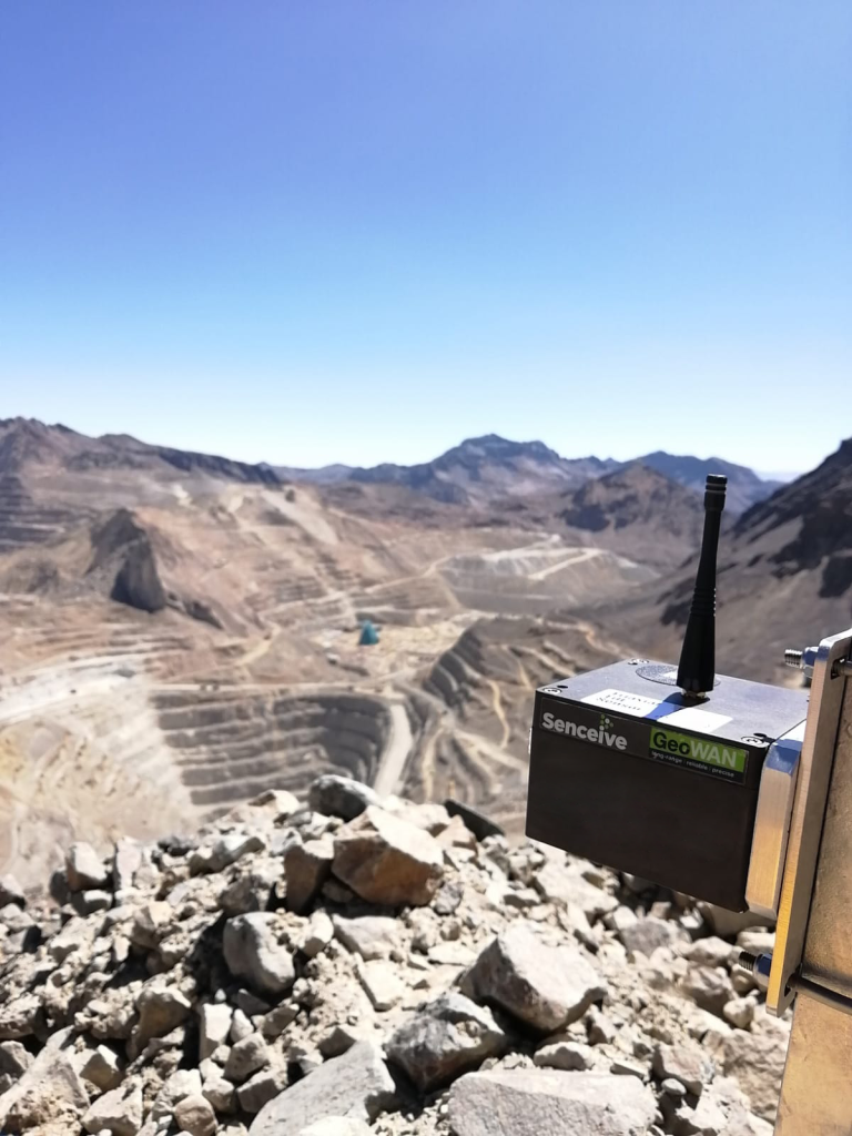
Some sensors, such as analogue piezometers and inclinometers, require manual download, which constrains sampling and reporting frequency. Wireless remote monitoring systems, on the other hand, are fully automated and need little maintenance over their ultra-long (10 to 15 year) lives. These systems are most often used with tilt sensors, which provide precise measurement of structural or ground surface movement. Recent innovations such as the Digital Interface Node introduced by Senceive enable users to bring many more third party sensor types into the wireless landscape, with all its advantages such as automated alerts and remote access. The Digital Interface Node can connect to a wide range of geotechnical, structural and environmental instruments and sensors, provided they feature a digital output. These can be as diverse as weather stations, borehole piezometers to assess changes in ground water pore pressure and borehole inclinometers to characterise lateral ground movement. In most applications it is configured to transmit data to the user via the cellular network.
Combining the capabilities of the Digital Interface Node with other wireless sensors such as tilt meter nodes and cellular cameras allows geologists and mine operators to track changes such as shallow ground deformation with changes in water content or instability of soil and rock much deeper below the surface. This can be essential to assess the safety of critical mine assets such as tailings dams because failure mechanisms such as slip planes can develop unseen deep within the structure, often taking months or years before causing a sudden collapse. Some experts (such as the team lead by landslide specialist Alexander Puzrin) believe this type of delayed slip mechanism led to the catastrophic failure of the Brumadinho dam in 2019 causing the death of at least 290 people.
In other cases, we have seen failures where surface deformation measured by tilt meters has been evident in the form of gradual creep or a series of small steps, but with no indication of an underlying problem.
This highlights the importance of combining subsurface geotechnical monitoring with surface deformation monitoring.
New IoT devices like Senceive’s Digital Interface Node make this much more achievable because they enable coordinated automated logging of borehole instruments such as in-place-inclinometers (IPIs), extensometers and piezometers with surface sensors such as wireless tilt nodes.
In conclusion, the growing range of IoT sensors and the associated data processing and visualisation technologies are paving the way to safer, more productive mining, more robust risk management and smarter preventative maintenance.
To read more about remote monitoring for mining, click here.
