
Mining is an industry as old as time and it involves a variety of cogs and key players to make the process successful. This is why Juniper Systems’ rugged data collection tools are the modern mining solution.
The latest mobile technology greatly improves the majority of aspects of mining. A variety of processes can be highly simplified such as data collection, communication, safety monitoring, mapping, real-time communications, equipment maintenance, and more. Juniper Systems provides rugged and practical solutions to the job site and beyond. Here is what Juniper has to offer to streamline the mining process.
Mesa rugged tablets
Take your office anywhere. The Mesa® family of rugged tablets are designed to work for you while out in the field. They can withstand extreme temperatures, moisture, sand, and dust. Plus, they have all-day battery life and a wireless connection for easy communication. The Mesa Pro is IP68 certified with active cooling. And both the Mesa Pro and Mesa 3 are Class I Div II certified for safety. Available in 7-inch and 10-inch screen sizes, the mining industry greatly benefits from tablets such as these for a variety of reasons.
Data collection and assessments
With a Mesa Rugged Tablet, data collection and management are simplified. You can input geological information, metrics, safety inspections, and environmental data all in one place. Data can also be analysed by key players such as Geotechnical Engineers for slope stability analysis, ground control monitoring, geological surveys, and rock mass characteristics directly on site of the mining location—no need to be in an office setting.
Communication and safety
Everyone involved in the project, from supervisors to control rooms, can use the tablets to communicate with each other in real-time through a wireless internet connection. Send messages and share images or videos to effectively communicate during a project. Tablets can also be used for collecting and storing data while monitoring safety, such as gas levels, ventilation systems, and environmental conditions.
Mapping assistance and equipment maintenance
Rugged tablets can help accurately map mine sites, record GPS coordinates, and navigate complex mining environments for easy mapping access. Maintain equipment by connecting the tablet to sensors and diagnostic systems for performance metrics, maintenance schedules, and machinery health.
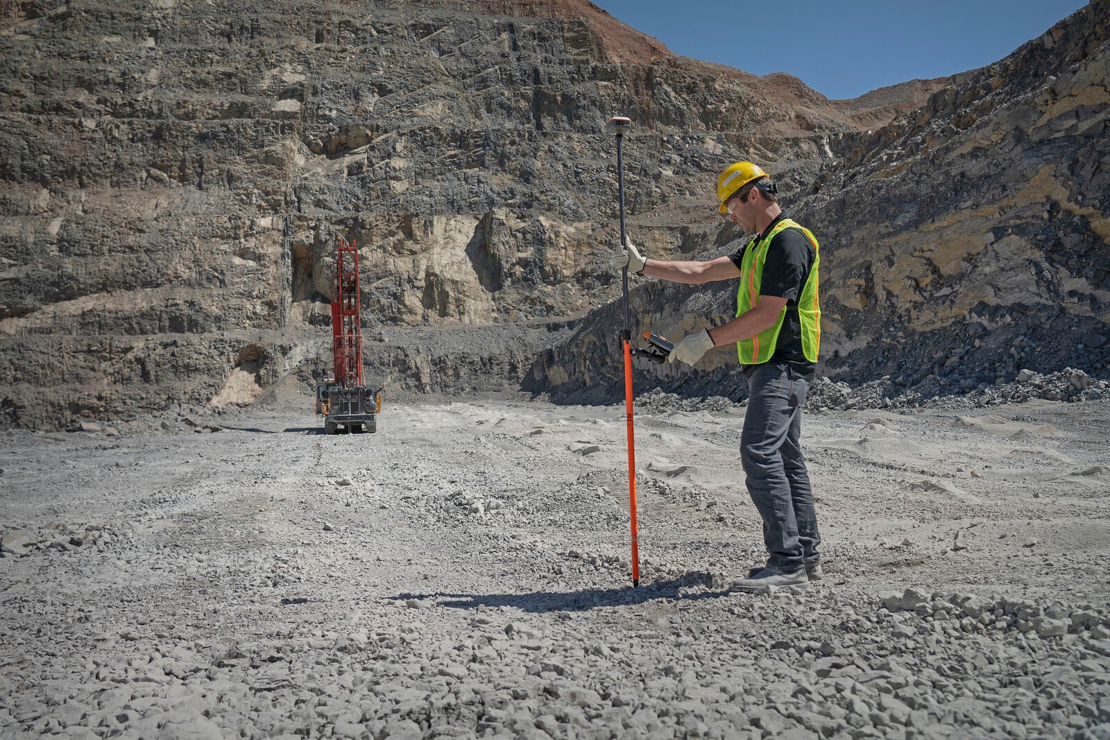
Geode GNSS receiver
Juniper’s Geode™ Global Navigation Satellite Systems (GNSS) receiver provides real-time data with sub-meter, sub-foot, and decimeter accuracy with one push of a button. Here are some ways the GNSS receiver helps in mining:
Mapping and fleet management
GNSS receivers can help provide accurate and easy mapping of mining sites, determining the location of points, boundaries, and features on the ground. GNSS receivers can also be installed on fleet vehicles with our powered dock to track the locations of the vehicles themselves, monitor their activities, optimise their routes, and identify potential hazards to avoid accidents.
Grade control and stockpile management
With a GNSS receiver, mining operators can accurately determine the grade and depth of ore bodies, optimizing drilling and blasting processes. They can also be used to measure the number of stockpiles of minerals, helping mining companies manage inventory, estimate reserves, and plan extraction.
Environmental and geotechnical monitoring
GNSS receivers aid in environmental monitoring by tracking changes in land surfaces, water bodies, and vegetation. They also help ensure safety by monitoring slope stability and detecting potential instability issues.
Uinta mapping software
Juniper’s Uinta™ mapping software provides user-friendly data collection and mapping capabilities, with a high level of customization for any project. Here are ways mapping software can help the mining process:
Exploration and resource assessment
Mapping software allows geologists and mining professionals to create detailed geological maps for monitoring changes and analyzing assessments all in one place.
Mine planning and operational monitoring
Uinta mapping can help optimise pit and mine designs to determine the best locations for infrastructure, haul roads, waste dumps, etc. Mapping data can also be used for monitoring mining operations, tracking equipment, managing personnel, and ensuring adherence to safety protocols.
Environmental planning
Mapping software can help mining companies comply with environmental and safety regulations by providing accurate, detailed, and up-to-date reporting. It can also help monitor progress and ensure compliance with environmental restoration requirements for land rehabilitation after a mining project is complete.
From planning a mining project at its conception all the way to land rehabilitation, going digital brings endless possibilities. Easy communication, project management, safety, and environmental monitoring are right at your fingertips. Juniper Systems provides accessible and useful tools for mining worth its weight in gold.
About Juniper Systems Inc.
Juniper Systems is a world leader in the design and manufacture of ultra-rugged handheld computers and provides field data collection solutions for use in extreme environments.
To learn more about Juniper Systems products, visit the website or contact our team of experts.
