
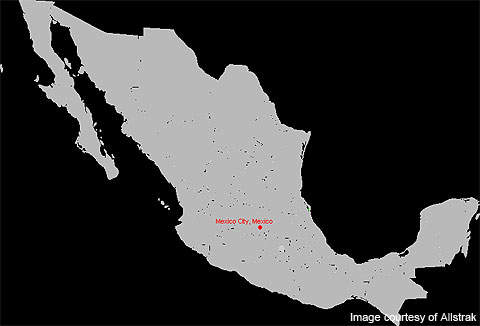
Pericones Silver Project is located approximately 160km south-west of Mexico, within a well-known silver vein hosted belt. Owned by Kimber Resources, the project is an 11,890ha property and includes two contiguous concessions La Guera and Ampliacion La Guera. Originally 6,300ha in size, the property was extended in 2007 when Kimber Resources received the approximately 5,568ha Ampliacion La Guera concession.
The property was acquired by Kimber Resources through a gradual process of staking. Although staked earlier, the acquisition was officially announced in 2006. Kimber Resources began drilling at the mine on 1 April 2010.
Recommended Buyers Guides
Pericones Silver project mineralisation and geology
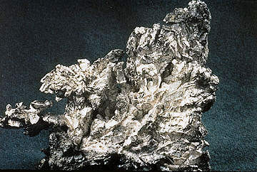
The property consists of four major alteration and mineralisation zones – Plaza de Gallos, Aguacate, Tejamanil and El Cirian. All the mineralisation zones are associated with silver and gold-hosted veins and shears.
Plaza de Gallos is a 2m-wide mineralised structure that hosts silica, carbonates and clay minerals. It also hosts brecciated silica cemented by later silica. The structure is accessed by a 100m-long and 3m-wide adit. Along the entire length of the adit, silver and gold mineralisation is hosted within 1.3 to 3.0m-wide structures.
Sulphides ranging up to 2% of the siliceous material are found within the vein. The sulphides are characterised by fine grained pyrite and small amounts of sphalerite and chalcopyrite. The walls of the rocks are altered variably, with pervasive chlorite and calcite being the most common alteration.
The Tejamanil structure is dominated by two partially parallel shear zones that are hosted within altered volcanic rocks. A wide sulphidic shear zone found within sedimentary rocks characterises the El Cirian structure. The structure is located nearly 2km southeast of Plaza de Gallos.
The Aguacate structure, located 3km southeast of El Cirian, consists of several mineralised bodies along a 1.6km long shear zone. Many of the mineralised bodies are hosted at angles lower to the regional shear.
Pericones Silver project exploration
A diamond drilling programme began on Pericones on April 2010 at its primary mineralisation structure, Plaza De Gallos, which will initially cover 2,500m to 3,000m. Seven holes extending 950m were completed by April 2010. The samples have been sent for testing to the assay laboratory.
The property has been explored historically since the colonial times. Early stage exploration work on the property was carried out during 2008 and 2009. In March 2008, rock sampling, prospecting and mapping of alteration were undertaken. Surface mineralisation over 900m of strike from the adit portal at Plaza De Gallos was mapped and tested.
Five samples ranging between 190m and 160m overlying the mine operations were collected. Results indicated a potential of high-grade silver mineralisation. The surface samples reported between 171g/t to 242g/t silver in chip samples with more than a 1.5m width.
During the exploration programme, a 110m-long, two-level adit that was excavated in the 1980s was also mapped and sampled. The underground sampling returned between 225g/t and 1,362g/t silver and between 24 g/t and 0.60 g/t gold.
Exploration at the El Cirian structure reported values between 128g/t and 307g/t silver and between 0.17g/t and 0.48g/t gold over 3m.
During exploration at the Aguacate structure, approximately 15 structures and 45 historic mine operations were identified. Exploration at this structure returned values between 324g/t and 1,290g/t silver, and between 0.12g/t and 0.67g/t gold over 1.3m and 1.5m.
Mine infrastructure
The mine is easily accessible through well-maintained infrastructure developed around the mine site. Two 20km paved roads with parallel hydro lines from Tejupilco city cut across both the concessions. The local communities are connected through several well-maintained gravel roads. Streams and rivers running through the concessions provide water throughout the year. The property lies less than 10km from the power network.