
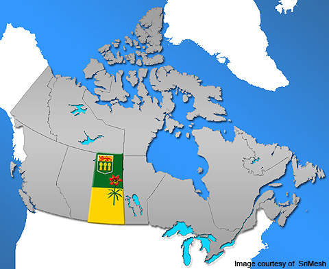
The Burr project is located 140km east of Saskatoon in Saskatchewan, Canada. Owned by BHP Billiton, the property is spread over an area of 79,946 acres in the potash sweet spot, which is also called the conventional mining corridor. The potash mine will be developed as a conventional underground mine.
The project was earlier owned by Athabasca Potash. It was acquired by BHP in March 2010 when the pre-feasibility study was still underway. BHP Billiton is currently reviewing the project. The mine is expected to have an estimated life of 50 years.
Recommended White Papers
Recommended Buyers Guides
Burr project reserves
The property hosts high-grade, high-tonnage reserves. As of 29 May 2009, measured mineral resources at the deposit stood at 125mt graded at 21.27% potassium oxide (K2O). Indicated mineral resources total 299mt at a grade of 23.07% K2O. Inferred mineral resources at the deposit have been estimated at 186mt at a grade of 23.55% K2O.
Burr project geology
The property lies within the Elk Point Basin, which contains three evaporitic centres – the Northern Alberta situated in the north-west of the basin, the Central Alberta and the Saskatchewan sub-basin in the south.
The Burr project is hosted within the Saskatchewan sub-basin. The deposit contains a Prairie evaporite sequence that overlies and underlies several stratigraphic horizons. An erosional surface, termed the Mannville Formation and Mannville Marker, defines the lower contact of the Cretaceous shales. It comprises unstratified water bearing sands, silts, mudstones and shales.
The Souris River stratified salt horizon that ranges in thickness between 15m and 30m includes dolomitic limestone beds identified specifically as Lower Harris and Upper Davidson. A second Red Bed, used to define the topography of the target mining levels, lies immediately above the Prairie Evaporite horizon. The structures of the second Red Bed demonstrate a marginal change in elevation at a regional level.
The Prairie Evaporite structure plunges steeply in the surrounding area of collapses.
Two classes of collapses besides a Devonian anomaly have been detected in the Burr region. Large Winnipegosis mound complexes identified in the Burr region are categorised as off-mound and on-mound if none and one mound exists, respectively. A few pinnacle shaped mounds have been identified in the north-east corner of the region. The areas under the Winnipegosis mounds demonstrate sagging of the overlying Prairie Evaporite. Carnallite of low density are hosted within the underlying formations.
High-grade potash mineralisation
The deposit is a high-grade potash mineralisation hosted within three salt members of the Prairie Evaporite Formation – the Patience Lake member, the Belle Plaine member and the Esterhazy member. The Patience Lake member consists of two sub-members namely the Upper and Lower Patience Lake.
Potash-bearing salt beds were formed in the Saskatchewan area during the middle Devonian period.
The Prairie Evaporite formation includes halite, sylvite, carnallite, anhydrite, dolomite and clays. Halite is hosted within thick beds with grained crystals ranging in size up to 10cm. Sylvite crystals, found in sizes between 0.5cm and 2.5cm, are usually anhedral, with few partially anhedral. Sylvinite is hosted in cyclical sequences usually at the bottom of a sequence. Carnallite, usually between 0.5cm and 10cm in size, is found along with sylvinite or halite at the corners of the salt members.
The project area is hosted within carnallite zones for both the Esterhazy and the Belle Plaine members. Insoluble components are found as fine disseminations in the evaporite salts and hosted within 1m-thick salt beds as interbeds. Multiple clay horizons can also be traced and identified within the project area.
Burr project exploration and drilling
Until 2009, exploration of the Burr project area included both two dimensional (2D) and three dimensional (3D) seismic survey programmes in addition to the drilling of 17 potash wells. A 90km 2D survey was completed in 2006.
In 2007, the drilling of five potash test wells extending 5,617m was completed. The following year, a 60.2km² 3D survey was completed along with the drilling of seven potash test wells extending 7,541m.