
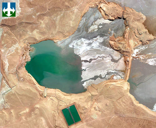
Bloom Lake Iron Ore Mine, Quebec
Champion Iron restarted the Bloom Lake Iron Ore Mine in Fermont, north-east Quebec, Canada, through its subsidiary Québec Iron Ore in February 2018.
You have successfully submitted your enquiry. Someone from our company will respond ASAP
Terra Remote Sensing is an innovative remote sensing company specializing in the acquisition, analysis and presentation of spatial data. As a 100% employee-owned remote sensing company, our shareholders are the technical and professional staff running day-to-day operations. We offer world-class expertise and state-of-the-art digital airborne mapping, marine mapping, and GIS support solutions.
With over 25 years of experience as a remote sensing company, Terra has worked on every continent in over 20 countries on a wide range of projects. With offices in Canada, the US, Chile and China, we are a flexible solutions-based organization with global capacity.
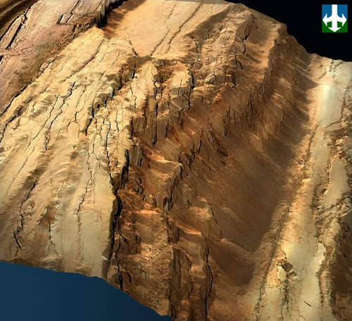
Aerial surveys support mineral exploration project phases. Aerial surveys can efficiently cover large and remote areas to assess regional geomorphology to support mineral exploration projects. LiDAR can effectively penetrate vegetation to generate bare earth models to aid in mineral exploration projects. This provides the means to identify surficial expressions of geological zones that are not visible in traditional photography. Detailed topographic data obtained by LiDAR surveys can help guide ground-based exploration projects making them more efficient and lowering environmental impact risks.
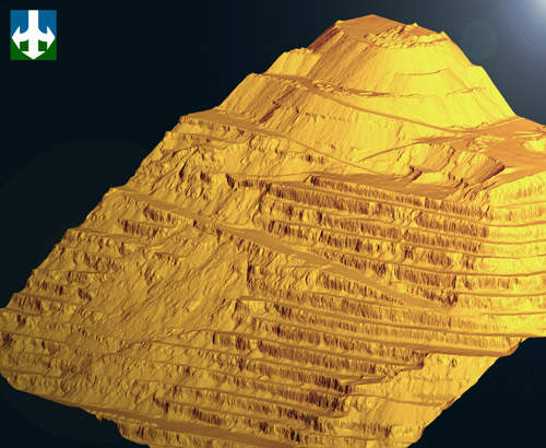
LiDAR combined with orthophotography is an efficient tool to aid mine planning. New mines, or expansion projects, need detailed and timely topographical information to accurately cost and plan the engineering and construction phase of the mine. Terra’s LiDAR can yield relative accuracies on the order of 10cm, which is highly valuable in a mine planning project. Terra provides LiDAR data in formats directly compatible with software applications used for detailed mine planning projects.
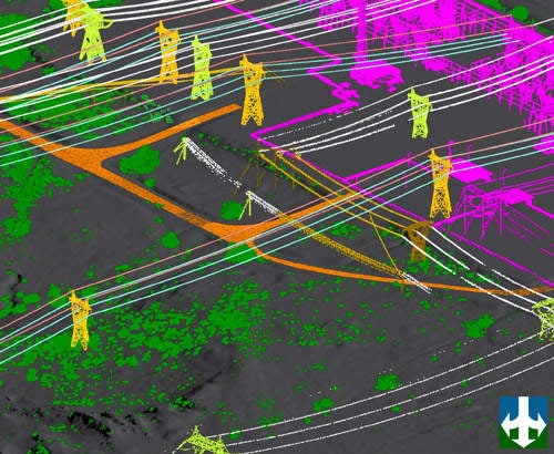
New mining operations need infrastructure. Terra’s LiDAR is relied on to generate PLS-CADD models to design or upgrade the transmission line that will provide electricity to mining operations. Terra provides data specifically formatted for PLS-CADD software used for transmission line modeling. In addition to PLS-CADD transmission line mapping, transportation routes and pipelines can also be designed or improved using LiDAR and GIS data collected from Terra’s integrated sensor array. Roadways and pipelines can also be more efficiently designed using LiDAR data.
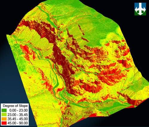
Active mine operations rely on airborne digital mapping data to effectively monitor active mining operations. Haul roads, tailings piles, benches and pit walls can be assessed for potential geohazards using digital mapping products generated from LiDAR data. Digital mapping data can be used with ArcGIS, Isatis and Vulcan software to take the guesswork out of slope stability and geohazard studies.
Mine reclamation is an important phase of a mining operation. Mine owners and engineering firms need good data to effectively decommission and remediate a mine site. Terra can provide LiDAR, hyperspectral, and digital orthophotos to support mine reclamation project phases. Following mine closure, detailed vegetation mapping can be carried out with a combination of LiDAR and hyperspectral data, which yield detailed physical and chemical characteristics of vegetation allowing for accurate monitoring of mine reclamation programs.
Champion Iron restarted the Bloom Lake Iron Ore Mine in Fermont, north-east Quebec, Canada, through its subsidiary Québec Iron Ore in February 2018.
Terra, an innovative remote sensing company specialising in the acquisition, analysis and presentation of spatial data, has the following perspectives on money, mining and mapping. Money Following a late December rally in 2010, there has been an early dip in the commod