
After LKAB’s Kiruna iron ore mine experienced a seismic event on 17 May 2020, the company relied on Hovermap technology, supplied by Swedish remote sensing specialist AMKVO, to assess the damage caused by fall-of-ground.
Here, AMKVO CEO Alex Paulusson discusses the assignment and the safety benefits autonomous scanning technology can offer when disaster strikes.
What was LKAB’s course of action following the event?
The mine was closed immediately and once that had occurred, determining how best to assess the affected voids became a priority. Kiruna management needed to be able to provide LKAB and the city of Kiruna, whose fortunes are wholly tied to the mine, with information about the status quo and an expected time frame for remediation. Hence, the objective was to obtain a comprehensive, accurate survey of the damage as quickly as possible – but without risking the safety of employees or contractors. LKAB got in touch with us and on 31 May our personnel arrived on site and commenced the mapping process.
Can you describe the scope of work?
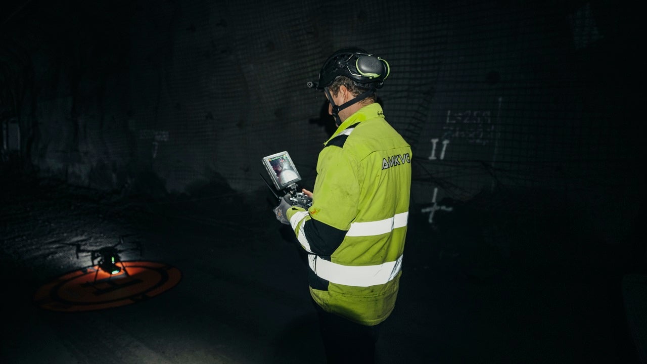
Initially, our team spent four days underground using Hovermap, handheld or mounted to a DJI drone, to map the damage. We completed 30 scans in very challenging conditions. There were collapsed services, ventilation bags and rock falls to contend with, along with a huge amount of dust. Fortunately, Hovermap is extremely robust and the dust didn’t interfere with the flying process or compromise the quality of the output. Even in sections of the mine where it was so thick that we couldn’t see the drone, we still got perfect scans of the drifts. Data was sent to the surface as it was collected. Scans were merged and georeferenced so LKAB’s mine planning and safety teams were able to begin analyzing the data straight away.
How does Hovermap compare with the traditional tools and methods used to assess falls of ground?
In terms of efficiency and safety, there’s absolutely no comparison. Historically, mining companies would have had to carry out manual inspections, slowly and carefully, often over several weeks or even months. Surveyors would have taken photos and made notes and the process would have been labor intensive and inaccurate. Some areas of the site may have been deemed permanently inaccessible because the safety risk was just too great. The use of drones and scanners represents a quantum leap forward when it comes to inspecting these sorts of risky and challenging environments. No one carrying out the work need be exposed to any kind of hazard and it’s possible to obtain an accurate picture of the damage within a matter of hours or days.
Is LKAB likely to continue using Hovermap across its operations?
Yes. After a very positive presentation to the Board, LKAB went ahead with the purchase of its own Hovermap for use in Kiruna. In recent months, that’s been put to work surveying several ore passes weekly. One other LKAB site has also made a successful case for acquiring Hovermap units. I would say it’s definitely here to stay!

