What is SBAS?
Positioning data is a fundamental part of many modern technologies, used in GPS tracking for smartphones, navigation systems for aircraft and sea vessels, and transportation management infrastructures that connect cities and regions.
SBAS serves to provide more accurate satellite positioning capability to the entirety of Australia and its maritime zones by augmenting Global Navigation Satellite System (GNSS) signals. This improved positioning technology would provide services that were previously expensive and limited to specific areas and niche markets.
Go deeper with GlobalData

The technology works using GNSS satellites alongside a geostationary communications satellite to broadcast the signals across the regions, as well as an uplink station, ground reference stations and a Ground Master station to communicate with the satellites from Earth, processing and correcting signals sent between the satellites.
But how does this technology differ from existing positioning services?
Geosciences Australia spokesperson Dominique Haraldson explains: “Google Maps is not a GPS service, but makes use of the information provided by the GPS satellite signal that is received by the location enabled device (i.e. phone, in-car satellite navigation system, etc.). With SBAS, accurate positioning information can be received without the need for mobile phone or internet coverage.
“SBAS will transmit positioning data to users from a geostationary satellite, meaning anyone in Australia’s land and maritime zones will have access to more accurate (10 to 50 centimetre) and reliable positioning data.”
How well do you really know your competitors?
Access the most comprehensive Company Profiles on the market, powered by GlobalData. Save hours of research. Gain competitive edge.

Thank you!
Your download email will arrive shortly
Not ready to buy yet? Download a free sample
We are confident about the unique quality of our Company Profiles. However, we want you to make the most beneficial decision for your business, so we offer a free sample that you can download by submitting the below form
By GlobalDataSBAS improves the reliability and accuracy of information carried through the GNSS by correcting signal measurement errors and providing information about the integrity, accuracy, availability and continuity of the signals.
Are there any limitations to the technology? Haraldson clarifies: “The signal can be degraded as it travels from the satellite to the receiving device. Limitations exist where the signal from the satellite is physically blocked, by dense canopy, tall buildings or if operated inside.
“This is no different to the current limitation of receiving a Global Navigation Satellite Signal, such as GPS.”
According to Australia-based research organisation FrontierSI, which was responsible for managing and completing user testing for the system for Geoscience Australia, SBAS “overcome[s] the current gaps in mobile and radio communications” and can be combined with on-ground operational services and infrastructure to ensure that accurate positioning information can be received anywhere and at any time across Australia, New Zealand and their maritime zones.
FrontierSI tested SBAS with 100 organisations, through 27 projects and across ten industry sectors, with these trials laying the foundations for a fully-operational SBAS by 2023.
Speaking at Central Queensland University in August 2019, Minister for Resources and Northern Australia Matt Canavan expressed his hopes for SBAS: “We all know how important GPS is to get us from point A to point B, but improved positioning is also essential to open up new opportunities for our businesses and industries.
“An independent economic benefits analysis of the [SBAS] trial showed the economic benefits could top A$6 billion in Australia over the next 30 years through increased productivity, better health and safety outcomes and improved environmental management.”
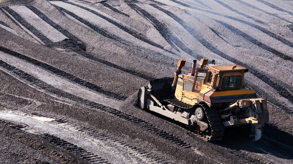
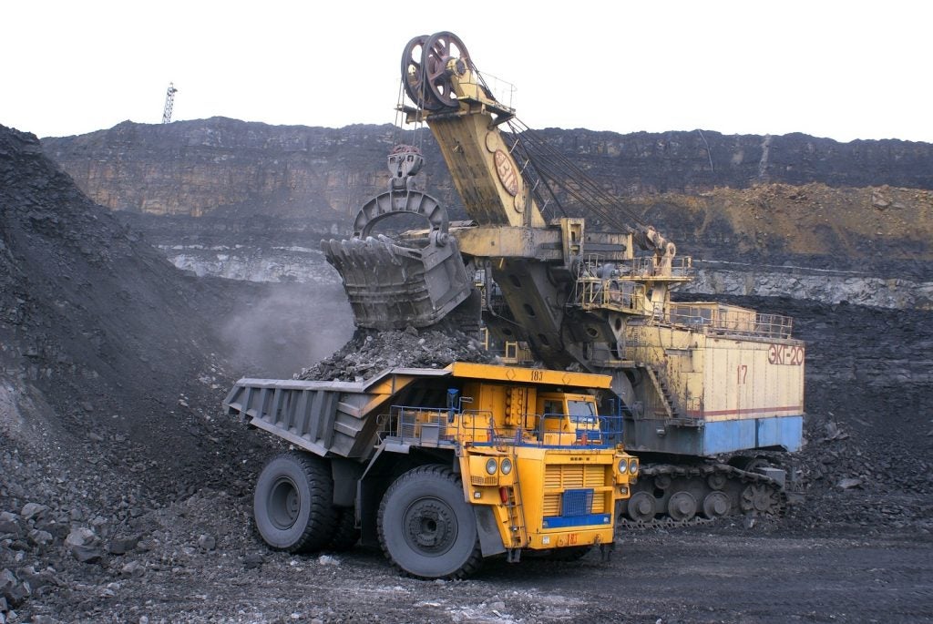
Tracking trucks
One of the sectors FrontierSI tested SBAS with was the resource sector, and a fully-operational SBAS could reap great economic benefits for the mining industry in Australia. According to Haraldson the technology was initially developed for the aviation space, so it was “surprising” to Geoscience Australia show that the technology could benefit the Australian resource sector over the next 30 years.
One area in the mining sector that could benefit from improved satellite positioning data is the tracking of capital equipment, including vehicles. Larger mine sites typically employ high-precision GNSS satellite systems on critical equipment such as loaders, but lack this precision with tracking systems on smaller and less critical pieces of equipment.
SBAS allows more precise tracking across a mining company’s capital resources to be more economically and logistically feasible, ensuring greater control over where and how the equipment is used in mining operations. According to Canavan, this could save the mining industry A$577m through improved efficiency of mining haul trucks.
This greater tracking of capital resource can also prevent accidents on-site such as vehicle collisions and reduce “environmental incidents” through the use of exclusion zones and hazard detection systems.
By giving mining companies enhanced positioning capability, operators can locate idle equipment faster, saving time and resources through more efficient equipment management and maintenance. FrontierSI estimates that 205,000 hours of haul truck vehicle downtime could be avoided with SBAS, potentially resulting in an operating saving of A$130m over a 30-year period.
This could also improve shovel and loader availability, allowing companies to locate these pieces of equipment when they are parked in varying locations and saving time that would have been spent searching for them.
Exploration and production
Mining companies can also use the improved positioning data offered by SBAS to help establish mining sites, as well as exploration and prospecting activity. Positioning plays an important role in all activities along the mining production chain, including locating mineral deposits, drilling activity and the protection of environmentally and culturally sensitive areas.
The precise positioning technology offered by SBAS will allow for more efficient and effective mining operations by better defining the locations of current or future mining boundaries.
The improved positioning software could enable quick and accurate geological mapping that can be easily converted into geological models, providing higher resolution maps to determine drill and blast parameters. This would allow for greater blast control and more uniform rock fragmentation, which in turn would lead to better digging conditions and an improvement in equipment productivity.
Uniform rock fragmentation also reduces the loading time required to fill mining haul trucks, further increasing efficiency of mining operations.
FrontierSI estimates that 23 million tonnes of iron ore production could be enabled through better shovel productivity with SBAS, potentially resulting in operating expenditure savings of A$229m over a 30-year period.
Exploration drilling would also require less survey support, with on-board guidance systems for drilling rigs locating the precise drill hole locations, drips and angles needed. This would save significant amounts of money and resources for the mining sector.
Another way SBAS could help in production at mines is through increased materials management. Precise positioning combined with on-board visualisation systems for loader operators could provide more accurate boundaries for ore types, avoiding ores that have high moisture content or are heavily mixed with clay and could affect the efficiency at ore processing plants.
FrontierSI’s findings indicate that mining companies could save A$636m in operating expenditure savings through better material management, allowing the production of an additional 64 million tonnes of iron ore over a 30-year period.
These potential benefits to the mining industry have yielded significant investment from the Australian government to implement SBAS at scale. Haraldson says: “In the 2018-19 Federal Budget, the Australian Government announced an investment of A$224.9m to enable precise positioning for Australia. The purpose of the program is to deliver a national capability that accelerates the adoption and development of location-based technology and applications.
“Funding of A$160.9m supports the development of SBAS while a further A$64 million is dedicated to upgrading Australia’s ground network through the National Positioning Infrastructure Capability.”