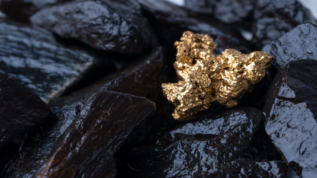
Earth AI is a new mineral exploration platform, generating an ever-growing, ever-learning geological map that could help companies find the best reserves quickly. Could this be the future of mineral exploration?
Developed by a Sydney University PhD student Roman Teslyuk with help from his friend, web designer Igor Gerechko, Earth AI is an online mineral exploration platform. The system analyses the input of geophysical, satellite and geochemical data, to predict the mineral composition of areas and allows users to upload their own information so that the training data pool is constantly growing.
Go deeper with GlobalData

Earth AI hopes the platform will improve mining companies’ capabilities to predict where future deposits lie, facilitating the comparison of formations and signatures. Airtree and Blackbird Ventures, two of Australia’s biggest technology venture capital funds, are two of the most high-profile recent investors in Earth AI. In a recent funding round, the firms invested A$500,000 to help build the platform.
The company has already grown to a team of five and is working with more than 60 mining firms on both trial and paid contracts. Here, founder and CEO Roman Teslyuk talks about the origins of Earth AI.
Molly Lempriere (ML): Where did you get the idea for the platform?
Roman Teslyuk (RT): I started my PhD in Sydney University in 2015, and we were working with a lot of geochemical data. We collected 300 samples within the project and analysed them for 45 elements. When we started interpreting what the data means, it became confusing very quickly because you have a lot of papers saying different things; one says this geochemical signature is a specific subduction signature and another paper will say it’s plume or crystal contamination-related.
At the time I didn’t have any machine learning skills, so instead I went to the global GEOROC database and downloaded available two million data points. I then narrowed these down to just the rocks alike mine, which were high-magnesium and low-titanium rocks, and I just mainly classified it. This took me three weeks to finish.
How well do you really know your competitors?
Access the most comprehensive Company Profiles on the market, powered by GlobalData. Save hours of research. Gain competitive edge.
Thank you!
Your download email will arrive shortly
Not ready to buy yet? Download a free sample
We are confident about the unique quality of our Company Profiles. However, we want you to make the most beneficial decision for your business, so we offer a free sample that you can download by submitting the below form
By GlobalDataAfter that, I presented my results to the people at the university – the worldwide classification of high-magnesium, low-titanium rocks. The response I got was, ‘It’s very subjective, you’re pigeonholeing whatever you want to, whichever rock group you want’. So, I said ok, I’ll do it more objectively. I’ve learned some simple clustering and showed my results again, but my colleagues were not interested. Thus, I couldn’t continue learning about AI within my PhD and had to do it in my own time.
ML: When did the platform get funding from Sydney University’s INCUBATE start-up programme?
RT: First of all, there was a course for PhD students called Inventing the Future, where we were split into teams to work on different innovative problems. For our team, the problem was related to nanosatellites in space; we quickly learned that building a satellite is very expensive and the capabilities are too small to do a viable start-up, despite the fact we thought they might be very useful for better data analysis.
After the course I called my old friend and business partner Igor. He’s a web developer and I’m a geologist so it seemed a logical partnership. I didn’t know much about machine learning so I did some analysis at that point and together we created our first prototype of Earth AI.
We went to the International Joint Conference on Artificial Intelligence in Melbourne last November. I thought that a platform like this would probably be something that already existed and I just hadn’t heard about it. But we asked everybody and they said that no one was actually doing it. It was then that we started to apply to the INCUBATE programme at Sydney University. We were accepted and started working with the mentors, got some office space and a small amount of funding, $5,000.
We needed to find companies to work with, so I just decided to cold call everybody and from that we got our first customer in February called ActivEX in Brisbane. By the end of March we already had ten more customers, so then we could start raising the money we needed to grow.
We’ve continued to attend different conferences, meeting more companies, and now we probably have 65 customers.
ML: Could you talk me through how the platform works?
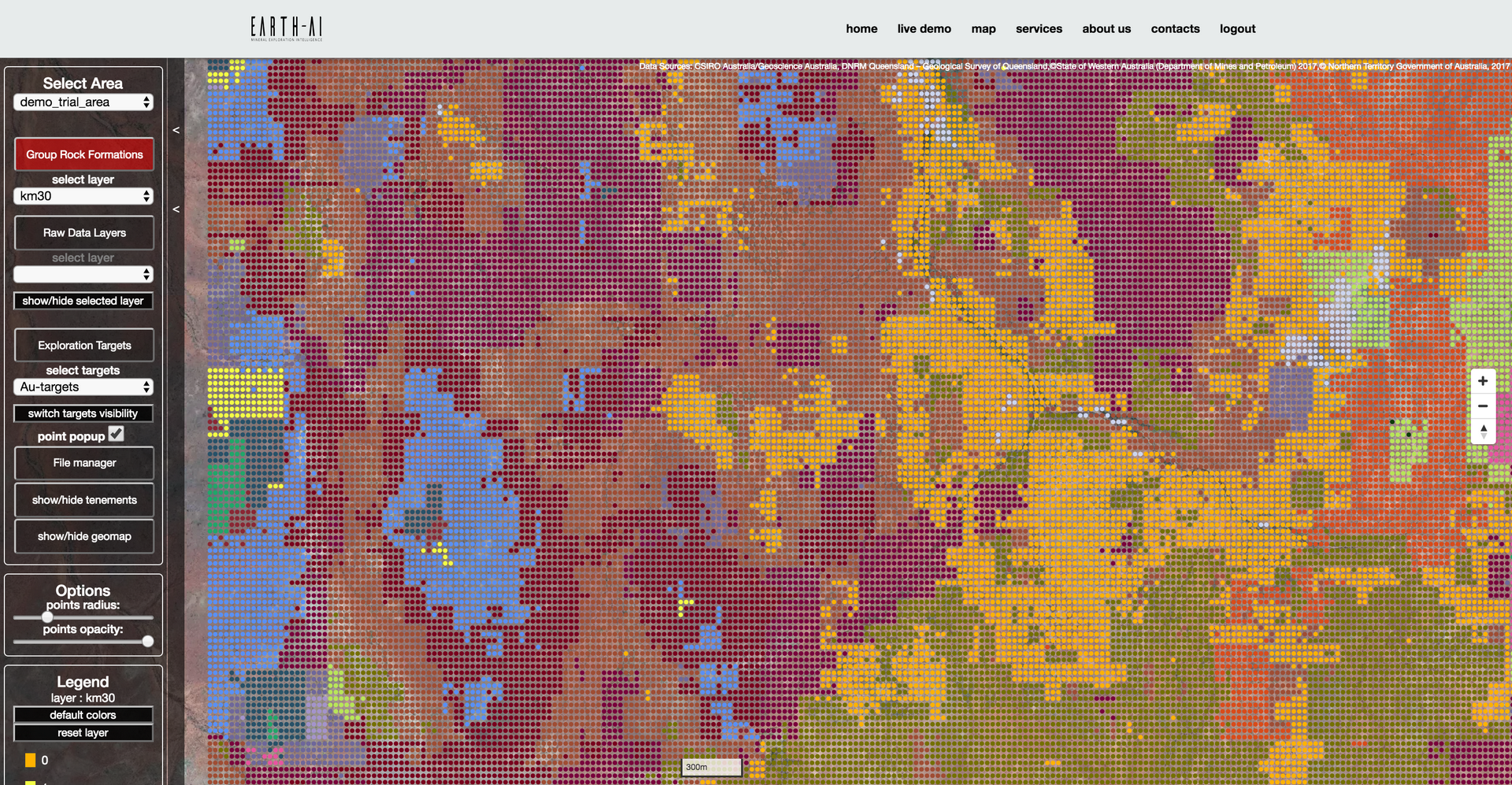
RT: For the trial, we have a database of Australia that uses remote sensor data. We use satellites to collect this, working with joint data from NASA, some data from Japan and also some Australian servers. There are satellites sensing data all over the world, so we use that data together with all the open source data from Geoscience Australia and other geological servers in Australia, these provide geochemical data.
First of all, we can apply unsupervised machine learning to create a data-driven geological map. Each rock has a unique signature, so if you identify these you can then put those signatures into a geological map. We’re using our network to categorise this data in a new way. There’s all this geological data and the geochemistry, and together they make a big difference to exploration.
It helps to find a link between raw, remote sensed physical data and geochemical validation, basically. So we have a lot of geological data already, why not learn from that and start to find out what particular signatures are linked to all the samples?
ML: Why do you think this method hasn’t been done before?
RT: I don’t know; from talking to people it seems there have been a lot of attempts, especially from larger companies that have done case studies. But they didn’t have a team themselves so they always had to contract somebody to do the job for them.
First of all, you need a lot of domain knowledge to make it work. I kind of know what makes sense and what things to use because I’m a geologist. So, rather than me having to explain it to somebody else who has the skills of data science and coding skills, I can bridge the gap without loss of information. So they struggled with it for a while, but if you have to consistently work on it to make it work, it’s not really successful.
The last thing, I guess, is actually validating the data. You might try a lot and get different analyses; it’s very dependent on the database that you’ve got and also to the area that you’re predicting. You have to be a geologist working on the ground to be able to differentiate what one makes sense, compared to the other ones which aren’t super correct.
ML: Have you faced many challenges developing it up until this point?
RT: Every day. We have had a lot of computational challenges; some databases are up to 3TB so we’ve have problems with how long they take. It could be a week to get the relevant information and then after a week, you look at it and it’s completely wrong. So you’ve wasted a week, just like that. We’ve had a lot of problems just with errors on the technical side.
ML: Is that what’s next for Earth AI, continuing to build-up the amount of data that you have?
RT: Yes, and we have several other ambitions. We want you to be able to supervise where you can improve the geological map by constantly giving your own observations, so changing our approach into more of a group one with our customers.
There is no option to travel everywhere and to every site so, instead, we want our analysis to just send you to the areas where there is the highest chance of discovering something. But also, if we could build a vehicle later, an autonomous machine that could go and analyse soil samples, that would be really helpful for exploration companies because they could focus on specific areas without travel. They could get a lot of the data and understanding of the ore body and the surrounding area autonomously.