
The Ministry of Water Resources in India is using leading technology to carry-out a complete inventory of the country’s groundwater resources.
The Ministry of Water Resourcesin the Government of India understood early on the enormous task it faced in the mission to map the entire country’s groundwater resources. Nothing similar had ever been done before, other than a project that had been carried-out in Denmark with good results, but to do so in a country 75 times larger was unprecedented.
With a growing population, along with increasing urbanisation and industrialisation, sustainable access to clean water is crucial to the continued improvement of public health, education and the struggle against poverty; all cornerstones of the UN Millennium Development Goals.
The Ministry of Water Resources appointed the National Geophysical Research Institute (NGRI) to be responsible for carrying out a preliminary study. The preliminary study will spend two years mapping eight selected areas with highly diverse geological conditions, with the aim of evaluating measurement methods and results.
The NGRI, which includes India’s foremost researchers in geophysics, quickly determined that a combination of airborne and landborne TEM measurements, together with supplementary resistivity measurement and resistivity logging in boreholes was the most effective solution. As a first step, Guideline Geo / ABEM has supplied a number of ABEM Terrameter LS systems, and the next step in the preliminary study based on -based TEM, the NGRI has evaluated various systems and concluded that the ABEM WalkTEM is the most advanced and most suitable candidate.
Guideline Geo / ABEM project sales director Anna Öfwerman said: "We’ve worked together with NGRI for over 25 years on a variety of projects and of course we’re honoured to have the role as strategic partner and supplier in the world’s most comprehensive groundwater mapping project."
The preliminary study, which is being carried-out with financial support from the World Bank and the UN, should answer questions regarding costs, how long it will take, what resources will be needed, what methods are most appropriate and what information can be obtained from the gathered data.
As a partner to NGRI, ABEM has adapted both hardware and software to ensure the high quality, as well as the usefulness of the measurement data to ensure that correct conclusions can be drawn.
"Knowledge transfer is also an important part of the project where we teach NGRI’s staff how the methods work, how to obtain the measurements and how to get the most information from the collected measurement data," said Öfwerman.
Once the preliminary study is completed and evaluated, it will be an important part of the application for funding from the World Bank and the UN to continue the project; a survey that is expected to take twelve years.
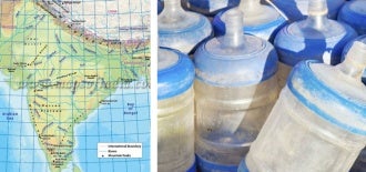
Image: India’s Ministry of Water Resources is using leading technology to carry-out a complete inventory of the country’s groundwater resources. Photo: courtesy of ABEM.